The ultimate photography guide to Big Sur in California. At the end of 2012 as I was planning my first Big Sur coastal drive along California State Route 1, I was surprised at how little information I could find related to travel photography on the Big Sur drive.
I found plenty of reviews and recommendations on wine tasting tours or how to spend 3 days at Hearst Castle, but not much on how to plan a photography trip. So I decided to make my own photography guide. On my first trip to Big Sur, I had to make all the discoveries on my own, and as result I missed many must-see destinations. So I decided to put together the top places to photograph in Big Sur with photography tips and directions for others to enjoy.
Table of Contents
Big Sur Photography Guide
What I realized after my first trip, is that it requires serious planning to capture those iconic Big Sur photos.The Big Sur coastal drive is unique in that for 300 – 350km you are presented with amazing views and photography opportunities every few hundred meters. If you keep stopping at every vista point and every state park you will need a week to complete the trip.
After completing the coastal drive 3 times now I am confident I can create a visual guide listing the key places to visit and to photograph, with many of them hidden or not too obvious, and some just too beautiful to omit.
1. Montaña Oro State Park
One of the largest state parks in California, and as a result it offers an extensive variety of natural attractions, with rugged cliffs, endless sandy beaches, coastal plains, canyons, mountains, and breathtaking views of Morro Rock.
Location: 35.2974, -120.8688
2. Spooner’s Cove
Spooner’s Cove is located just a few kilometers off the California Route 1, is one of those unexpected discoveries along the way. You make the wrong turn, or you get lost, and you have the chance to uncover some new, not very well known locations.
Location: 35.27488, -120.8883
- Going to Big Sur? Check out these 24 Of The Best Beaches in California
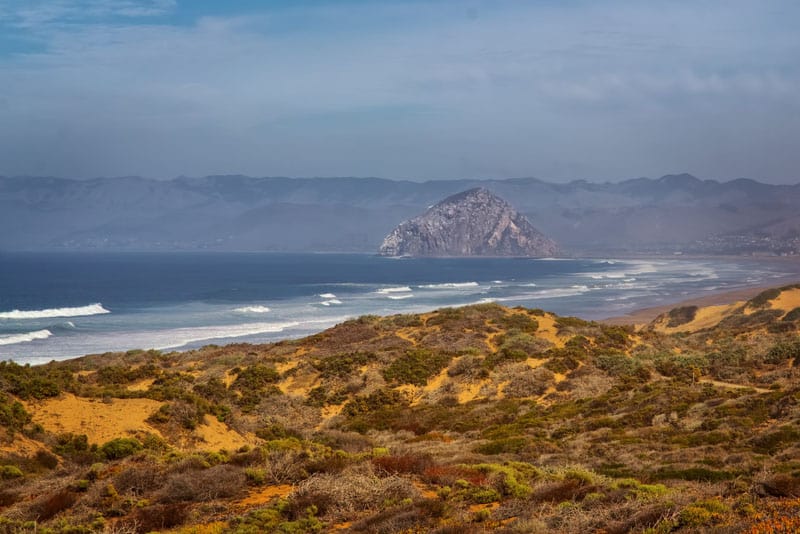
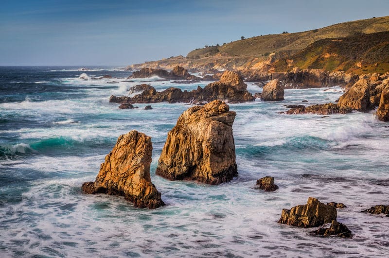
3. Morro Bay
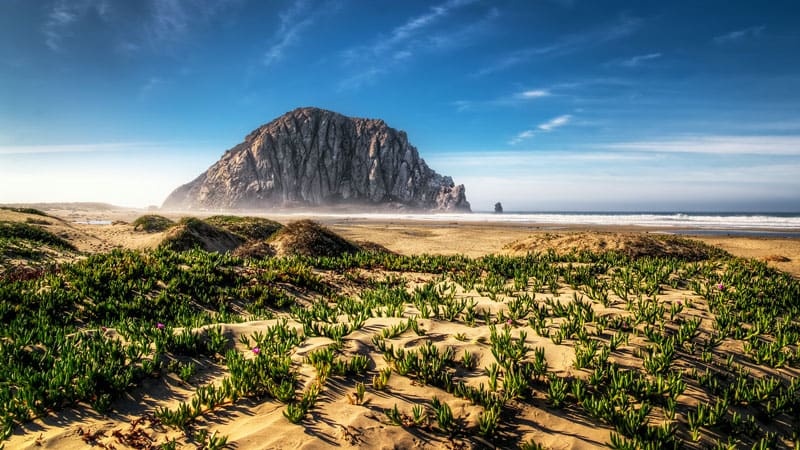
I love to visit the town of Morro Bay because of its main attraction, the 180-meter tall volcanic plug Morro Rock. The Rock is an amazing subject for your travel photos, and makes any composition distinctive and unique. My favorite spot in Morro Bay is the Morro Creek beach. This beach is the perfect place for a picnic, where you can spend hours watching surfers riding the waves with the Rock serving as the backdrop.
Location: 35.3862, -120.8639
4. Moonstone Beach
Moonstone Beach is where I normally stay for the night in Big Sur. I plan my schedule so I can check in to the motel an hour before sunset, and then I take only my tripod and camera and walk along Moonstone Drive as the sun sets. This spot serves as the final point of my sunset hike, and where I stay until the sun completely submerges into the ocean. Moonstone Beach is one of the best spots to take sunset photos in Big Sur.
Location: 35.355, -121.721
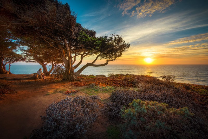
5. From Plains to the Mountains
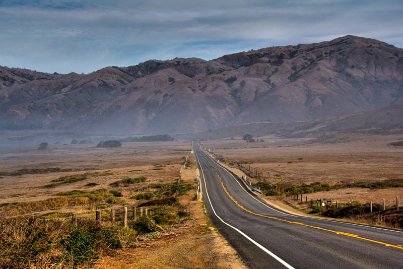
The Big Sur coastal drive has 2 distinctive parts: one is flat with beautiful dune beaches and wide coastal plains; the other is mountainous with twisted roads and a picturesque shoreline. This is the last stretch of the flat section on Route 1 just before entering the mountains, and the view serves as a preview to what awaits you over the next few hours. It’s a perfect spot for taking pictures.
Location: 35.7300, -121.3144
6. Ragged Point
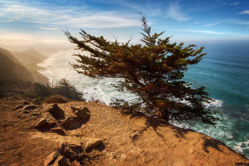
Ragged Point is the first vista point in the mountainous part of the coastal drive. After driving for hours on flat roads, enjoying views of open plains and endless dunes and beaches, the road finally hits the mountains. A few twists and turns later you reach Ragged Point. At this spot the view to the north is still obstructed by mountains and trees, but you can enjoy an open view to the south. Also, this is a great spot to observe whales and dolphins in the open ocean.
Location: 35.775716, -121.32746
7. McWay Falls
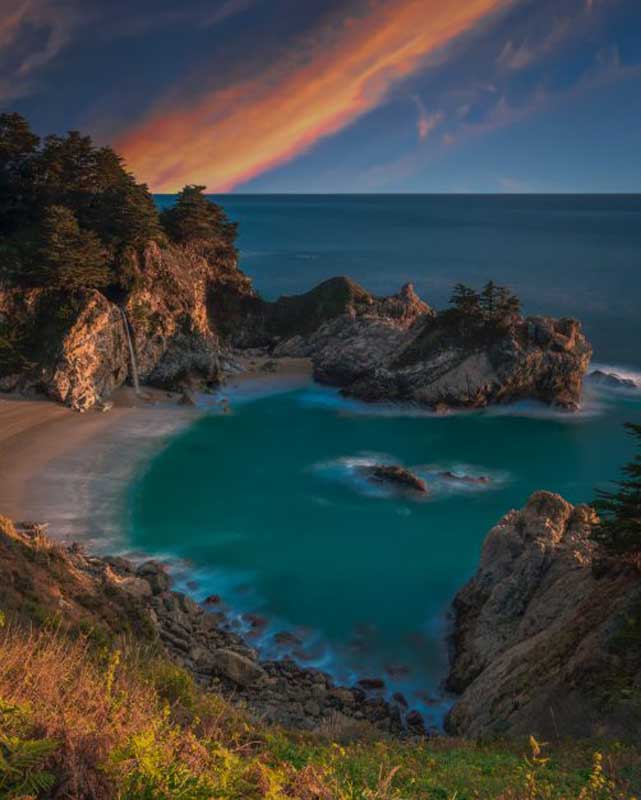
McWay Creek is located in the Julia Pfeiffer Burns State Park, and is one of those places you MUST visit while driving along California State Route 1. The creek is famous for its 80-foot waterfall and beautiful sandy beach, which makes it an ideal place for travel photography.
An interesting fact: the beach itself is only few decades old. Before, it was a rocky shore, but after a massive landslide in 1985 that rendered State Route 1 unusable for a year the sand beach was born.
Location: 36.15775, -121.67209
8. Pfeiffer Beach
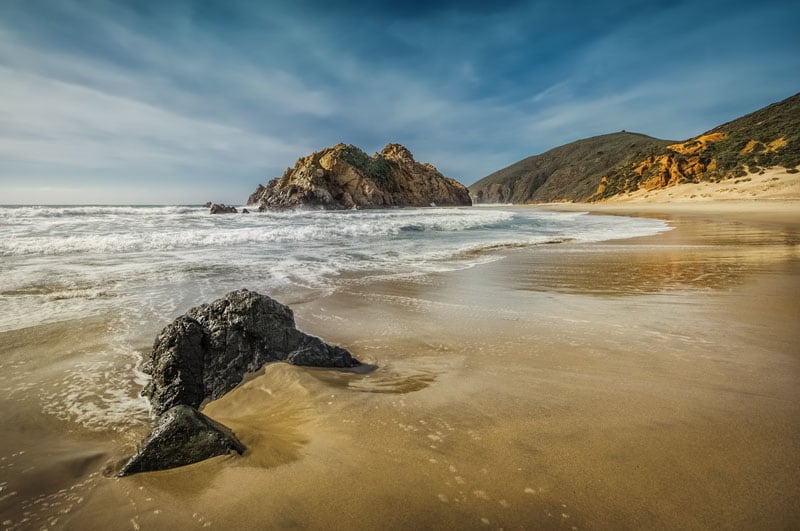
Pfeiffer Beach is a very special place. Probably the most beautiful beach of the drive, but at the same time its most secluded. To get to the beach you have to drive 5km through mountains on a one-lane road. If you drive during the high season it can be a long and challenging adventure. This is a good place to spend some extra time and have a picnic with a breathtaking view.
Location: 36.23815, -121.81489
9. Bixby Bridge
It is impossible to miss the iconic Bixby Bridge when driving to Big Sur since there is no way around it. You will find a decent size parking lot next to the bridge, but it does not look that impressive at close distance. The best view of the bridge is from a vista point that is around 2km south of the bridge.
Location: 36.35747, -121.90265
10. Little Sur River Beach
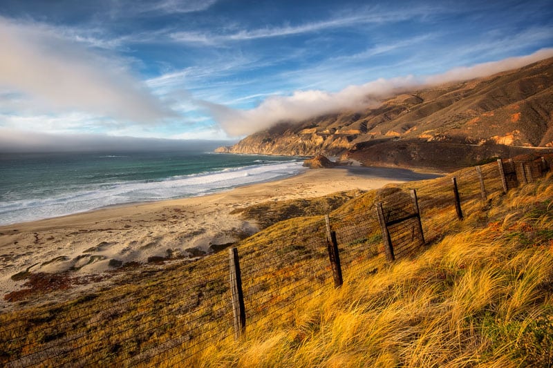
Little Sur River Beach is one of my favorite spots of the drive. It’s located where the Little Sur River empties into the Pacific Ocean, just a few miles from Carmel and Monterey. Even though it is a fenced private beach and there is no parking around it is worth stopping on the side of the road even if only for a few minutes.
Location: 36.331944, -121.889722
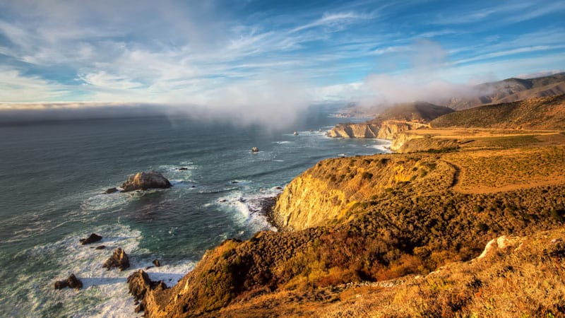
11. Garrapata State Park
Garrapata is located only 10km from the end of the drive (as you drive from south to north) and this is another don’t-miss destination along Highway 1 California Coastal Route. Due to the undeveloped nature of the coastal part of the park, most of the tourists just drive past it without realizing that they missed one of the most beautiful coastal hikes. You will need at least an hour at the park to complete the 3 km hike on top of the rugged coastal cliffs.
Location: 36.45381, -121.92597
12. Point Lobos State Reserve
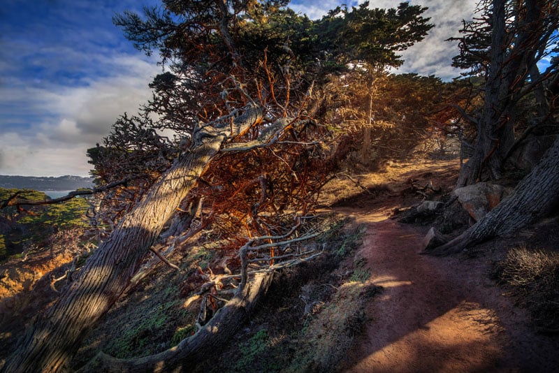
If I had to choose only one location to visit between Los Angeles and San Francisco along the scenic coastal Highway 1 I would not hesitate with my choice: it would definitely be Point Lobos. It is like the crown jewel of the entire drive.
Point Lobos has several sections spread across a large area of the coast. On my first drive, due to my poor planning, I had only 2 hours to spend in the park and as result I missed most of it.
Location: 36.52185, -121.95099
My advice for when you plan your Big Sur coastal drive; ideally, dedicate an entire day for exploring Point Lobos. It has an extensive network of hiking trails with most of them next to the ocean. And if you are interested in photography, Point Lobos is the ultimate destination for seascapes.
More Travel Photography Resources
- Landscape Photography: 10 Landscape Photography Tips You Can Implement Today
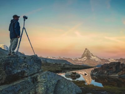
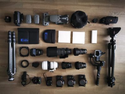
- Photography Gear: Travel Photography Gear Guide: What’s In My Camera Bag?
- Mobile Photography: The Best iPhone Photo Apps to Help You Shoot Like a Pro
- Photography Tips: Photography Tips from the Best Travel Photographers in the World
- Photography Guide for San Francisco: The Ultimate San Francisco Photography Guide
- Camping – Best Campgrounds in Big Sur
Read More About California
- San Francisco Itinerary: 72 Hours in San Francisco – A Local’s Guide to the City
- Yosemite National Park: Things to do in Yosemite National Park
- Los Angeles: 25 Best Things to Do in Los Angeles – Hollywood, Hikes, And More
- Northern California: 7 Epic Places to Visit in Northern California
- Road Trip Itinerary: The Ultimate California Road Trip Itinerary
- Lake Tahoe: Things to do in Lake Tahoe
- San Diego: Where To Stay In San Diego – The Best Neighborhoods & Areas
- The Best Things to Do in San Diego – A Local’s Guide to the City
- Beaches in California: 24 Of The Best Beaches in California
- Hiking in California: 15 Best Hikes In California – Inspiration To Get Outdoors

Thanks for presenting pictures of wonderful travel destinations in California. It’s great and amazing.
What is the best time to visit?
Moonstone Beach & Morro Bay are not part of Big Sur 🙂
What time of year would you recommend a week on this route?
We were there in April and it was a wonderful time. I assume summer would be quite busy. But being California, I would think anytime would be good.
Beautiful lifelike pictures and interest locations ! Thanks for sharing !
What a great post! The images are stunning – Though as a California girl I might be just a little biased!
Nice pictures collection of natural landscape. Thanks for sharing those amazing pictures!!!
I’m from LA and there is so much to see in this great state. One day I’m just going to get a car rental and go. Thanks for the tips and places to visit.
There is such finesse in the pictures. I wish I could be treading these pathways someday.
I like those pictures especially the one on the Monterro Bay
Amazing photography. great job. Thanks for posting
WOW! Really great photographers your are. Very impressive photos you’ve clicked and share your travel experience with us.
Your images are gorgeous. But this drive you document is really almost the entire Highway 1, not just Big Sur! In your photo of Pfeiffer Beach, I think a rock in the foreground resembles a baby whale or seal.
Carole, thanks for your kind words. California State Route 1 (Highway 1) begins in Los Angeles and ends not far from Oregon border. Almost 800 miles in length. I consider section from Morro Bay to Monterey (120 miles) to be Big Sur coastal drive experience.
Spectacular photos! The Ragged Point looks magical! Would love to visit the place one day 🙂
Wow. Really, really need to get my ass back to the Big Sur and drive the hell out of that gorgeous coastline again. As amazing as these photos are, nothing can possibly do it justice. It really is a driver’s paradise…
What a amazing destinations captured on pic, wow there are lots of hidden shangri la all around the word that have to explore great
Such amazing photographs! All these landscapes look like they come out of a fairy tale book. 🙂