Off the west coast of England, nestled halfway between the shores of Cumbria and Northern Ireland, the cliffs, beaches and seaside towns of the Isle of Man erupt from the Irish sea.
As the British Lake District creaks under the weight of a booming tourist industry, off-the-beaten-track adventure-seekers will want to find the best things to do on the Isle of Man.
It remains comparatively untouched but similarly offers thrills, dramatic landscapes, and quaint, picturesque settlements all in one package.
Undulating hills, lush green pastures, and a coastline of intricate caves and sandy coves; there is plenty here to explore, and all only a ferry ride from Liverpool, Heysham, Belfast or Dublin.
Planning tip: the direct ferry to Douglas is 2 hrs 45 from Liverpool and Belfast, 2 hrs 55 from Dublin, and 3 hrs 45 from Heysham!
Table of Contents
3 Adventurous Things to do in the Isle of Man
Here is a guide to three options for adventurous things to do on the Isle of Man – with pedals, paddles or boots.
Individually, each trip will give you a great view of the island, but they’re best when done together!
- Duration: Leave two to three weeks if you really want to take your time over it, but those up for a challenge may like to try completing all three recommendations in eight days (we did it in nine).
- Distance: Each leg is approximately 100 miles (160 km), so consider it a 300-mile triathlon of sorts!<
1. Cycling Isle Of Man
We chose to take on the 103-mile cycle following the ‘Lighthouse Challenge’ route in a day. With fresh legs on the first day of our adventure, we set off from Ramsey to conquer over 3000 yards of elevation (2750 meters) following the road in a counter-clockwise loop sticking to the coast as much as possible
Ramsey to Peel
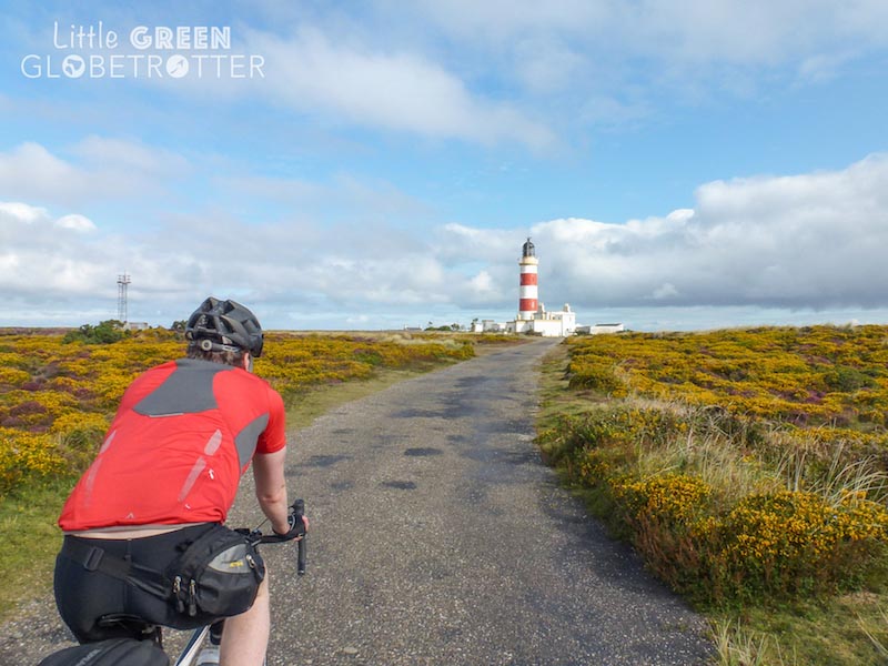
The Ramsey to Peel stretch via the Point of Ayre was a gentle warm-up for what was yet to come, with elevation gains over the northern plains of no more than 80 yards.
The roads were narrow but quiet, flanked by banks of wildflowers and grasses, beyond which heathland and agricultural land spread to the coast in one direction and as far as the eye could see in every other, punctuated only by the occasional farmhouse.
Planning tip: The official Lighthouse Challenge race starts and ends in Douglas and goes clockwise, but we wanted to finish in Ramsey ready for our kayaking leg. We chose to go counter-clockwise for no other reason than we would be doing the walk in a clockwise direction and wanted to mix it up; difficulty wise, both directions are comparable.
Despite being the easiest stretch of the route, the constant short, sharp inclines and swooping descents of the northwest coast are tiring and we definitely needed to refuel with a pub lunch when we got to Peel!
Peel to Port Erin
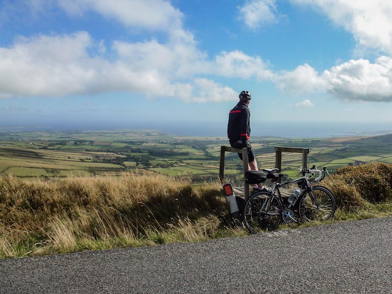
Feeling re-energized, we set off from Peel with an extra push in our pedal.
A short cycle south and we were confronted with the monstrous ascent up the infamous Sloc road, the pass over the Isle of Man’s second highest peak. It was a grueling 7.5 miles and we collapsed in a heap at the top, using the scenery as an excuse for a rest.
On a clear day, it is possible to see Ireland, Northern Ireland, Scotland, England and Wales from various points on the route, so we took the time to stop occasionally and marvel at the view.
What goes up must come down! Over a glorious 3.5 miles of fast downhill, we dropped 365 yards into Port Erin. With my fingers hovering over the breaks, I let gravity take me.
The wind hammered in my ears and my lungs filled with cold sea air. The bike faded away from my experience; I was flying. This moment, this sensation is what I love about road biking!
Port Erin to Douglas
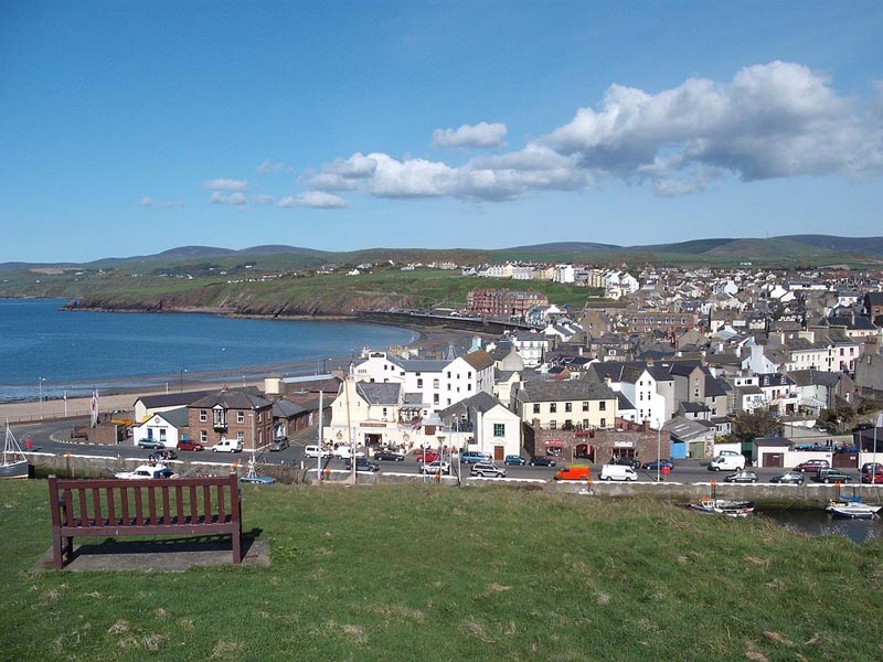
The steep climb to Cregneash, a farming village of picture-perfect thatched cottages overlooking the Calf of Man, felt more like a molehill after the Sloc.
Planning tip: A walk around the village as well as demonstrations and guided tours inside the Manx National Heritage Site cottages will transport you back to the 19th Century, revealing the traditional crofting lifestyle and farming practices, and introducing you to native Manx breeds.
Although it was certainly tempting to continue our journey northeast towards Port St. Mary, skipping the drop down to the coast only to turn around and retrace our route back up the sharp climb to Cregneash, we had heard that the southwesternmost tip of the island offers some of the best wildlife spottings in the British Isles.
Don’t Cut Corners
So, taking the opportunity to rest our legs, we freewheeled down the Sound Road and hoped the landscape and its inhabitants would be worth the effort required to get back up.
The Sound didn’t disappoint! Seals sunned themselves on the jagged rocks, unperturbed by the dozens of seabirds that shared their sunbed; the water swirled and frothed as it met land, and the Calf of Man glowed golden and earthy green in the afternoon light.
Planning tip: Keep your eyes peeled for puffins in this area, but don’t be fooled by the model puffins and their recorded calls placed along the coast in 2016 in an attempt to encourage breeding.
From May to August, basking sharks are regularly sighted, and dolphins are also known to frequent the area mostly from October to March.
Upon leaving Cregneash (for the second time!), we had a stretch of respite. The south coast is relatively flat all the way to Langness Lighthouse. After Castletown, the gradual incline over 6 miles required some perseverance but we were rewarded with a spectacular coastal ride along Marine Drive into Douglas.
Douglas to Ramsey
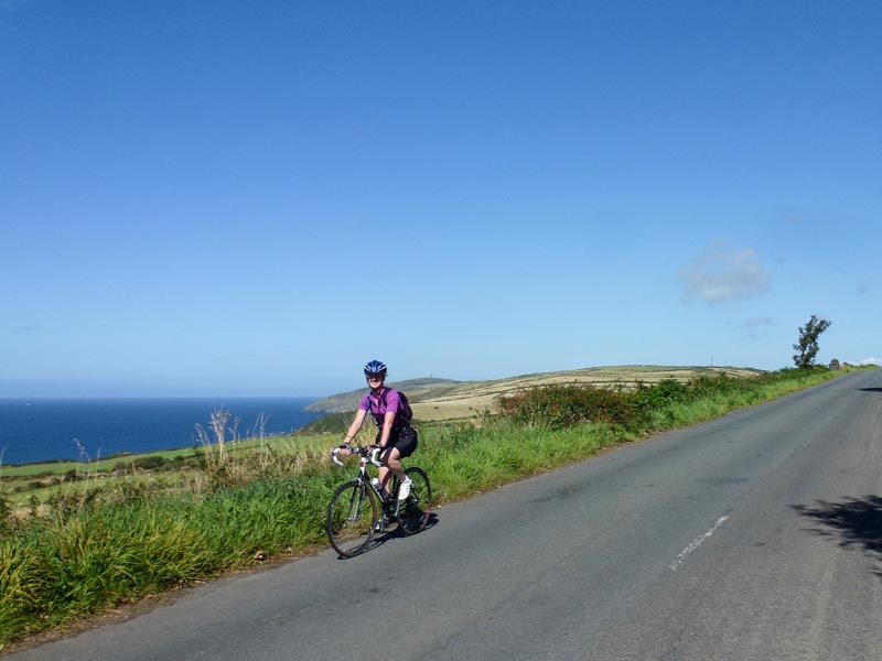
The Douglas to Maughold stretch was undeniably tough on fatigued legs.
Two seemingly perpendicular battles in quick succession required stamina and an ‘I can do this’ attitude. My heart sank as I dropped into the middle of these two hills and saw my next challenge looming in front of me.
Using my momentum from the downhill and flooding my muscles with oxygen from deep breaths, I put my head down and powered up.
The remainder of the route through to Ramsey was largely on a downhill trajectory, broken only by a couple of short, sharp climbs.
Strong cyclists can attempt the full 103 miles without stopping, but, since we intended this to be an adventurous way to visit the Isle of Man, we preferred to stop for meals and snacks, to take in the stunning landscape, and to learn about Manx history, rather than allowing it to whizz by in a blur and not really visit anything at all.
2. Kayaking Isle Of Man
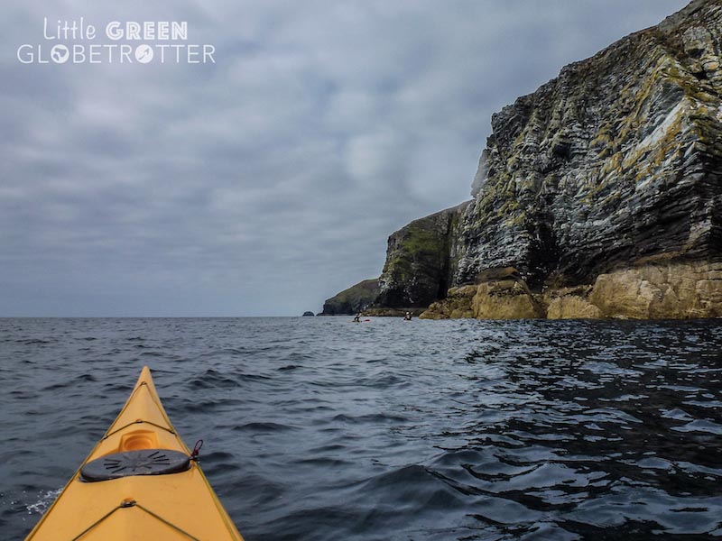
Port E Vullen to Derbyhaven
Surrounded by seals, we rested our paddles against the top of our double sea kayak and allowed the curious creatures to bump us from side to side. They each raised their heads above the water, expelled their held breath through stretched nostrils, and observed our response to their playful interaction.
Cautious not to knock them, we lowered our paddles to continue our journey, aware of the fading sun. The large mammals gave chase, our tiring arms no match for their strength.
This was the end of our first day at sea, which saw us paddle for 9.5 hours, with a break halfway for a picnic lunch and a stretch.
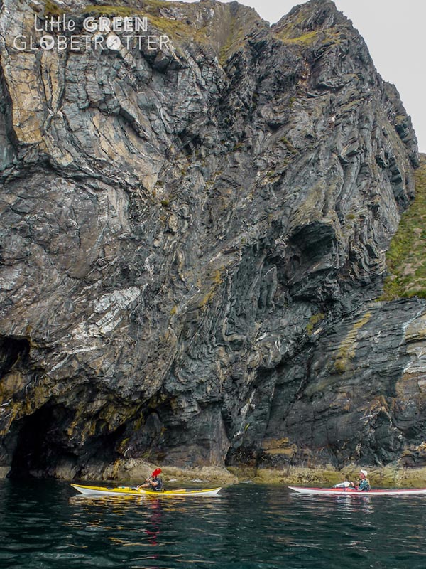
We set off from Port E Vullen beach, just half a mile from the Venture Centre, from whom we rented our kayak and were allocated two guides, Mike and Dave, to help us navigate these unfamiliar waters and ensure our safety at sea during our three-day circumnavigation of the island.
The eastern coastline, from Maughold Lighthouse all the way down to Langness Lighthouse, is creased in a gentle wave of beaches and peninsulas.
The water here is mostly calm and I was surprised at how clear the Irish Sea is along parts of this coast.
This crystal clarity excludes the waters of Douglas Bay, where there was a steady stream of traffic and the sound of ferry horns seemed to reverberate with the swell they created. ‘Might is right’ was a useful phrase to remember when negotiating our path past the island’s capital!
Ferry Crossing
Having had a run-in with the harbour master, who came rushing out on his boat to prevent us from crossing in front of a departing ferry we were grateful for the guidance of Mike and Dave, who clearly knew these waters and the ‘rules of the road’ like the back of their hands.
They navigated us from point to point to a beach near Derbyhaven, where we pitched our tents for the night and walked into town to find dinner.
Derbyhaven to Peel
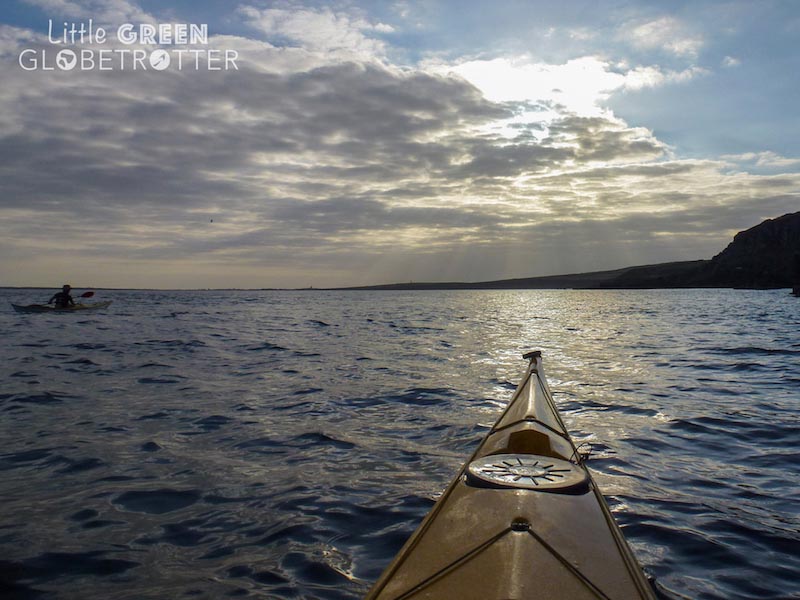
We woke with the sunrise the following morning and got going; we wouldn’t finish paddling for the day until after dark.
We paddled around the Langness Lighthouse peninsula and cut a path across each bay in turn towards the Calf of Man, encountering several herds of seals, a minke whale and a variety of seabirds.
The cliffs around the south coast are dramatic and impressive, and we took our time paddling through caves, exploring every nook and cranny.
Singular rays of light worked their way through gaps in the rock and penetrated the darkness, exposing anemones, sponges, and barnacles hiding in the depths below. This area is also popular among divers but, depending on the time of year, I don’t recommend jumping in!
12 Hours into the Day
More than 12 hours after we set off for the day, we decided it was time to stop for food, but our day was not yet complete! We secured our kayaks near Peel Castle and found a lovely restaurant for dinner.
The staff and patrons at The Boathouse were remarkably understanding of our bedraggled appearance and potent smell; adventure sport is after all the norm here, so no one was fazed!
Peel to Port E Vullen
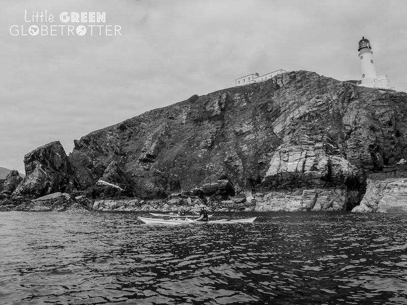
Feeling warmed and replenished, we headed back out into the now cold and windy night. We paddled for another hour and a half, our head torches illuminating our route across the churning waves.
By the time we decided to stop and camp on the foliaged dunes of an isolated beach, the icy water had cruelly left no clothing untouched and the cold permeated my bones.
We set up camp as efficiently as we could in the dark (and with frozen fingers!), and sleep soon overpowered us.
Kayaking Day 3
Our third and final day on the water was the longest. We fought our way up the northwest coast, playing games of ‘Capitals and Countries’ with Mike and Dave as our kayak was lifted and then dropped with a thud over every wave.
As well as being susceptible to strong wind, this stretch of coast is visually less enticing than that we had passed on the previous two days, and the sea stretched out to the horizon in front of us.
The Point of Ayre sat as a seemingly unreachable goal, with no heads, peninsulas or landmarks before it to break up our journey.
As the lighthouse finally came into view, we battled currents and riptides in an effort to round the point. As soon as we had, the change was instant; the wind ran out of puff and the sea forgot it was angry.
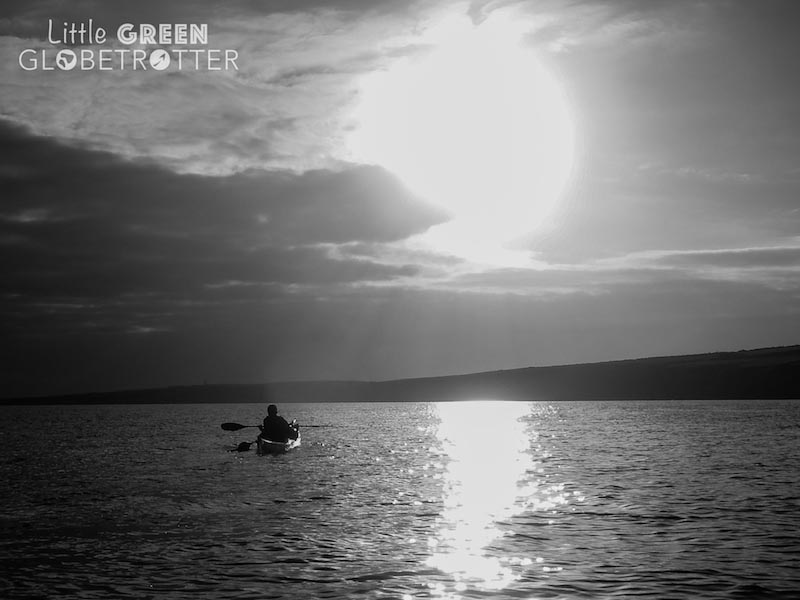
Our paddle back down the northeast coast past Ramsey to Port E Vullen beach was serene and effortless, and we were welcomed back to applause from the Venture Centre staff who had come to collect us.
We celebrated with our guides (who we can’t recommend highly enough and we would gladly spend future sea kayaking trips with next time we visit the Isle of Man!) before going in search of a hot shower and a comfy bed in preparation for the next leg of our adventure.
3. Hiking Isle Of Man
Don’t be fooled into thinking the walk is the easy option when it comes to adventurous ways to visit the Isle of Man! After a day in the saddle, followed by three days at sea, we found the hike far more exhausting than we expected!
The 98-mile Raad ny Foillan (Way of the Gull) footpath can be split into as many sections as walkers like; we decided to do it over five days.
Planning tip: Four days is considered a really tough challenge, twelve days is a much more leisurely pace for all ages and abilities and will likely allow some time for other activities and exploration of landmarks en route.
Having already done the cycle, we knew roughly what to expect, but of course, the well-signed footpath took us away from the road and deeper into the countryside, heathland, woodland and along breathtaking coastal cliff paths.
Ramsey to Douglas
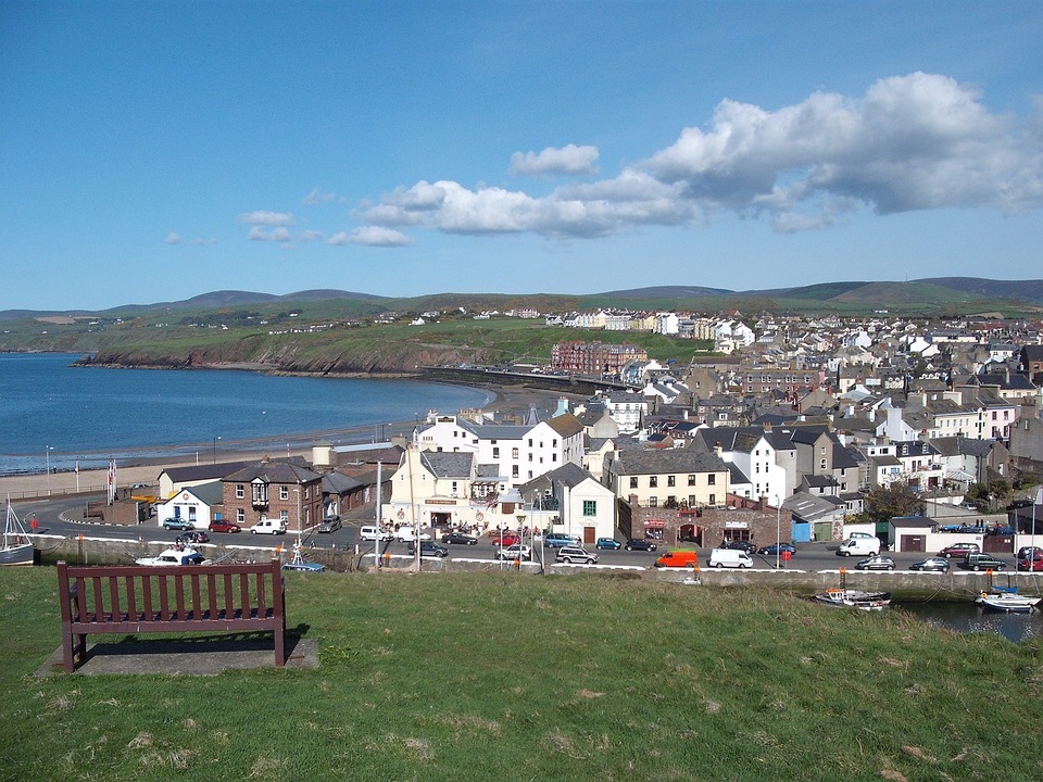
Leaving Ramsey, we soon found ourselves back at the now familiar Port E Vullen beach and then walking along the cliffs of the Maughold Brooghs into the village.
Beyond Maughold, the undulating country roads with some steep sections guided us inland, with views back over Maughold Head and across the Irish Sea to the Lake District.
A rapid descent into a secluded pebble beach was then followed by a section of path that snaked through dense woodland, before reaching the fishing harbour of Laxey
Planning tip: the Laxey Wheel is a popular tourist attraction and a wonderfully preserved example of 19th Century engineering that’s worth a quick stop.
We departed Laxey taking a steep footpath to Baldrine, where we left the path to explore the beach at Garwick Glen, meaning ‘pleasant bay’.
The romantic cove, followed by the Ballanette Reserve wetlands and the woodland of Groudle Glen, made for a beautiful afternoon of walking in three different ecosystems.
We ended the day in Douglas.
Planning tip: We factored in a whole day before our departure to see Douglas, so we didn’t stop here at all other than to sleep during our walk. There is plenty here to see though! Our highlight was the Steam Railway, which operates between Douglas and Port Erin, lasting one hour each way. During peak Summer months, there are seven trains each day.
You could either take a day off from walking to enjoy this trip, stopping at cultural heritage sites en route, or you could use it to skip out this section of walking if you really wanted, but you’d miss out so I don’t recommend this!
Douglas to Port St. Mary
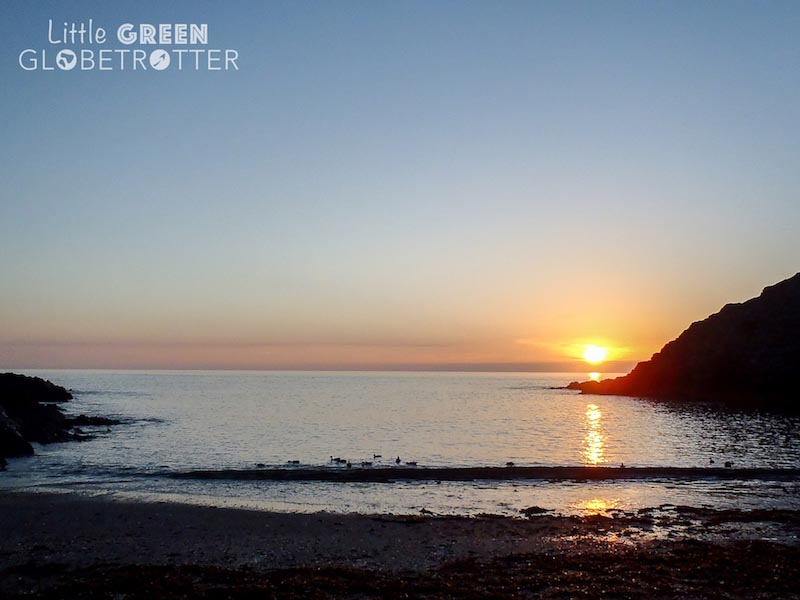
Heading south the next morning along Marine Drive, we were rewarded with clear skies and picturesque views over the coves and bays that litter this coast. We peered down the cliffs, searching for the opposite perspective to that we had witnessed from the kayak just a couple of days prior.
As we approached Derbyhaven, we passed the remains of Iron Age forts at Cronk ny Merriu and Cass ny Hawin, signaling our arrival in a region famed for its abundant archaeological sites.
Approaching Castletown
The walk from Derbyhaven to Port St. Mary was largely flat but full of sites that we wanted to visit. We followed the shore to the north of the Langness Peninsula, towards St. Michael’s Isle, more commonly known as Fort Island.
We stopped at Derby Fort, a circular fort built by England’s King Henry VIII circa 1540 to defend Derbyhaven Bay, before continuing south, past the Herring Tower, built in 1811, to Langness lighthouse.
In the center of the bay, we reached the morbid Hango Hill, an ancient execution site, all of which whetted our historical palate for the grand finale of Castletown.
With traceable origins as far back as 1090, Castletown is one of the oldest towns in the British Isles and was the Manx capital for hundreds of years.
Castle Rushen dominates the town centre; built in the 12th century and known for being one of the best preserved medieval fortresses in Europe, the Castle has served as a royal residence, a prison, and even a mint.
We explored the accurately decorated and furnished rooms, read about the Castle’s history and learned about the lives of its residents. The views over the harbour to the northeast and Market Square to the southeast are unrivaled.
On the way to Port St. Mary
From Rushen Castle, we continued our walk to Port St. Mary. The path followed the coast, with some spectacular views and only some very gradual uphills.
Despite the easier terrain compared to the previous day, we collapsed into bed in Port St Mary, having certainly clocked up an extra few miles exploring some of the island’s history.
Planning tip: There are a number of other popular tourist attractions and points of interest that we didn’t have time to see, including the Old House of Keys, the Nautical Museum, and the Old Grammar School.
Port St. Mary to Peel
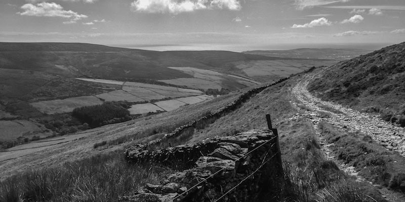
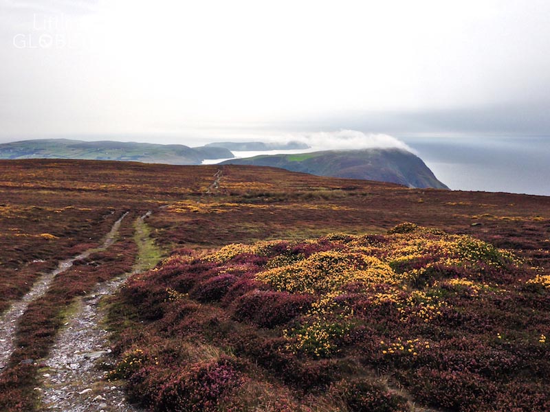
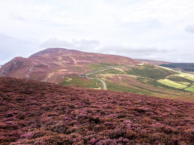
The next morning we began what would later be declared my favourite section of the 98 miles. The grass footpaths leaving Port St. Mary soon gave way to rock and shingle paths that meandered through heathland and lifted us up on to the cliffs of the southernmost peninsula.
We stopped again at The Sound to watch the seals, just as we had done during our cycle; you can’t tire of the sweeping views along the coast and across to the Calf of Man.
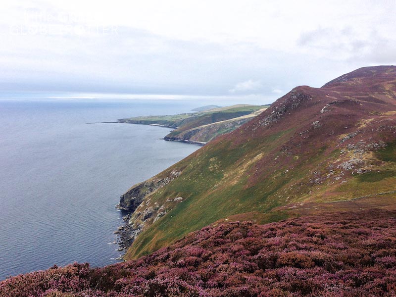
Continuing on to Port Erin and around the bay towards Milner’s Tower, the narrow path undulated along the vertebrae of the cliff tops.
Mist crept up and over the cliffs from the sea, slowly consuming the rocky hills and the carpet of purple heather speckled with patches of sunshine-yellow gorse, both in full bloom during the mid to late summer. The plum-hued landscape was dream-like.
Milner’s Tower watches over Port Erin Bay and from here we enjoyed the panoramic view before continuing along Bradda Head.
Planning tip: There are a number of other popular tourist attractions and points of interest. Castletown to Milner’s Tower is a great section for families not wanting to complete the whole route but nonetheless in search of a manageable challenge with plenty of history, spectacular scenery and an abundance of flora and fauna.
The mist continued to encroach and the visibility grew poor as we began our descent into Fleshwick Bay. We were aware that the rest of the day was going to be tough and we still had a lot of distance to cover, so we pushed on.
Ups, downs and more ups! This section was strenuous but, as we also discovered during our cycle, the views were worth it, both from the high vantage points (at Cronk ny Arrey Laa) and the low (particularly Niarbyl beach).
From Niarbyl, we followed the path into the lush, fairytale land of Glen Maye, past rushing waterfalls, and tranquil streams. The path snaked its way over the cliff top and brought us to Corrin’s Tower, atop Peel Hill. The day’s end was near!
With views over Peel and Peel Castle, we surveyed our destination in the now fading light as we descended onto Fenella Beach, a small cove dwarfed by the mighty castle that stands over it.
It was thankfully a short walk into town to find dinner and our accommodation. A comfy bed and a hot meal was our celebration after our most tiring and challenging day!
Peel to Smeale
With a relatively short day of fewer than 15 miles (24 kms) of walking ahead of us, we spent the morning exploring Peel. Peel Castle was, of course, our first stop, and we enjoyed discovering the remaining evidence of its many roles over the centuries: place of worship, fort of Magnus Barefoot, an 11th century Viking King of Mann, royal residence, and, until it was moved to Castle Rushen, the centre of government.
Early morning and evening are ideal times to visit as the soft light casts a warm glow across the eerie ruins.
Next stop was the House of Manannan, a fun museum that brings to life the Isle of Man’s Celtic, Viking and maritime history.
Viking History
They’ve achieved the ideal balance between informative and interactive, making it accessible for all ages without allowing the use of actors and reconstructions to become gimmicky.
Following the quay south, we made a stop at Moore’s Traditional Museum for a mouth-wateringly tasty smoked kipper bap for lunch, before circling back round via the Cathedral Church of St. German and on to the promenade to recommence our walk.
We walked north to the red sandstone cliffs that geologists estimate to be approximately 380 million years old and then ascended the steep hill with views back over the town.
By now, we were well accustomed to the need to look behind us as well as in front for the best viewpoints!
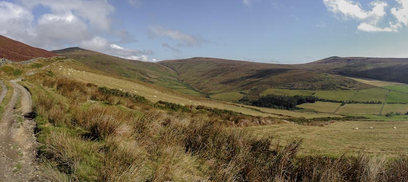
Following the footpath inland, we walked along sections of the old Manx Northern Railway and eventually came to some stone pillars, which is all that remains of the railway viaduct at Glen Mooar.
We continued to follow the railway past the old station buildings until we were eventually guided out from Glen Trunk, along with a small waterfall, at the sea.
The barren beach stretching out for miles ahead of us was in stark contrast to the grassy Glens, rolling countryside and tangled woodland from which we had emerged.
It was this same section of coastline that seemed to sprawl indefinitely from our kayak, but we knew the Point of Ayre was out there, hidden in the distance.
We had the choice of taking the coastal path, which runs adjacent to the beach through lichen heath, or walking directly on the sand and shingle beach; we chose the latter.
Planning tips:
-
Check tide times if you plan to walk on the beach as sections are restricted at high tide). From here, to the Point of Ayre, navigation was easy; we followed the beach, spotting seals, and birdlife.
-
The beach walk can also be broken up by coming inland at Jurby to visit the Isle of Man Motor Museum, the Jurby Transport Museum and St. Patrick’s Church, or to Andreas to visit the Kirk Andreas Church.) We came inland at Smeale to spend the night and then set off again the next morning for our final day!
Smeale to Ramsey
We felt jubilant as the Point of Ayre lighthouse came in to view; although not our finishing point, it symbolized the home stretch. We were grateful that our final two days of walking were leisurely and flat, as our legs and feet were understandably tiring.
Although by no means the hardest hike I have completed, when combined with the cycle and the kayak, we found that it was just the right combination of challenging and enjoyable, and enabled us to also learn about Manx history and culture en route.
We continued south along the beach all the way to Ramsey Harbour, where we made a beeline for the nearest pub to celebrate with something cold and refreshing!
Planning tip: Walking clockwise from Ramsey was a good call so as to end with the easy section!
The Isle of Man is famous for the TT (Tourist Trophy): an annual motorcycle race that began in 1907 is now known for being one of the most dangerous events on the motorsport calendar. Every Spring, for the fortnight of the TT, the island fills with petrolheads and the atmosphere becomes one of national celebration.
Adventure sport on the Isle of Man goes beyond this race, however, and the island is not just for lovers of motorsport.
There are many adventurous ways to visit the Isle of Man, and atop a motorbike is certainly one of them, but my experience was that exploring by pedals, paddles, and boots, allowed us to get under the skin of this beautiful island, revealing its rich history, enabling encounters with its wildlife, and exposing the great variety of its landscapes. An adventure lover’s paradise!
Author Bio
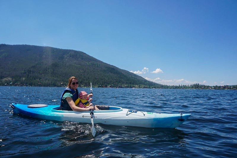
Joss, from Little Green Globetrotter, travels with her husband and their 2-year-old and writes about eco family travel.
They packed up and left their home in the U.K. last year to move to New Zealand, but they’re not putting down any long-term roots just yet!
They firmly believe that adventure is for all ages and Joss shares their tips for responsible and sustainable travel, along with helpful destination stories. Follow their family adventures on Facebook, Instagram, and Pinterest.
Read More:


Great post!!!!
thanks for the information..
The trip like this is really feel awesome. You experienced all the colour while travelling. This is really inspiring for me thanks for sharing such a wonderful blog.
This is such a great information. Thanks for sharing the experience and list of things to do there. This seams really amazing place.
Isle of man looks incredibly beautiful. Thanks for giving so many insights and tips!
This seems a very great place to test our adrenaline rush, the adventures that you have mentioned are amazing and I want to do them regardless of any place. Just had a read of a post which is of my kind. Thank you
Verry Interesting! I’m always learning something new when I read your posts.. Such a awesome list and view you capture. Great things to do there. Thank you so much for sharing a nice experiences! Ultimate place to visit.
keep going dear!
Verry Interesting! I’m always learning something new when I read your posts.. Such a awesome list and view you capture. Great things to do there. Thank you so much for sharing a nice experiences! Ultimate place to visit.
What a great adventures!! you shared awesome things to do there.. Ultimate pictures you captured.. Thank you so much for sharing this post.