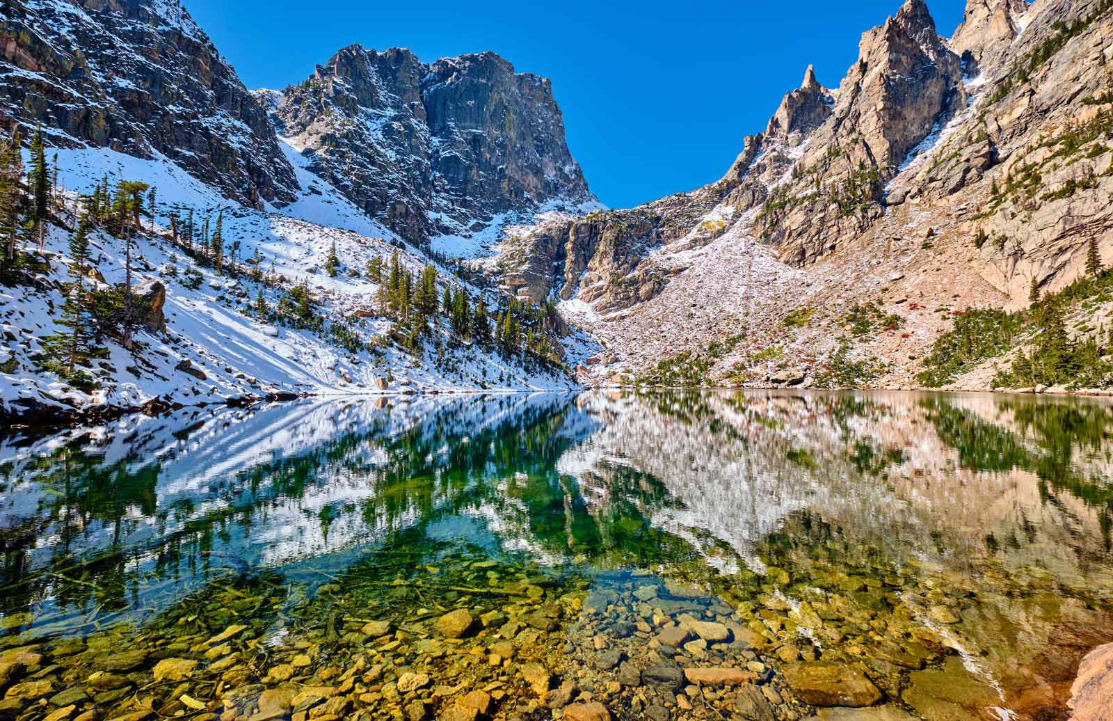
Truth be told, the best hikes in Rocky Mountain National Park are probably all of them. That’s because no matter what part of Rocky Mountain National Park you travel, you’re treated to 360 degrees worth of stunning views. If you’ve got a particular affinity for certain nature hike features like waterfalls or wildlife spotting then perhaps you’ll appreciate some hikes more than others.
However, if you love all that the great outdoors can offer then Rocky Mountain National Park trails delivers in spades. Whether it’s the famed Twin Sisters near Estes Park or friendly Bear Lake, you can take it as easy as you want or head up into the tundra region for a real adventure.
Table of Contents
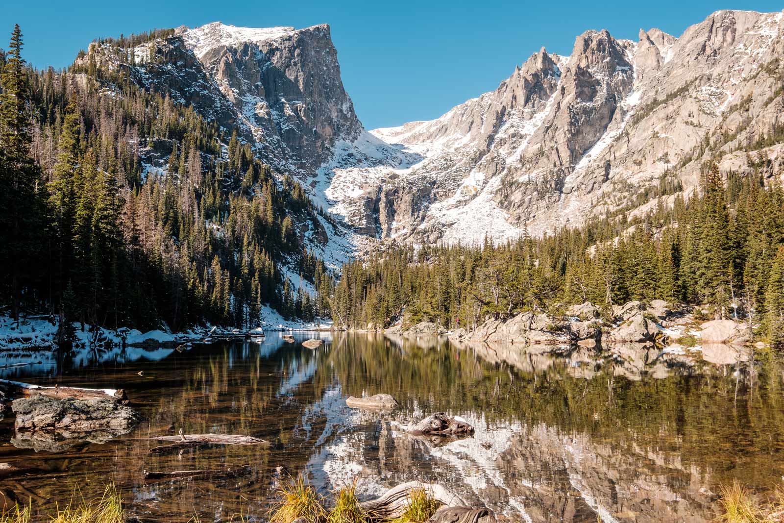
Rocky Mountain National Park in colorado
If you want to get right into the Rockies via your vehicle you can take the famed Trail Ridge Road. Trail Ridge Road is also known as the highway to sky road as it will take you from Hwy 34 in Colorado all the way above the treeline of Rocky Mountain National Park. That means you’ll be at an elevation of 12, 183 without ever getting out of your car.
Of course, you can use this road to also get to many of the trailheads, park your car and get out and hike Rocky Mountain National Park as it is meant to be explored. If you are interested in hiking in other areas around Colorado make sure to check our guide to the Best Hikes in Colorado for all the information.
Some areas of Rocky Mountain National Park may be closed due to fire damage. For more information on openings visit the npsWebsite/FireInformation.
Explore More United States National Parks
- United States: Best National Parks – US Edition
- Badlands NP: Badlands National Park Hikes and Things to do
- Zion National Park Hikes: 10 Best Hikes in Zion National Park
- Yosemite National Park: Things to do in Yosemite National Park
- Get your Pocket Guide to the Best Easy Day Hikes of Rocky Mountain National Park
- Pick up your map of the Rocky Mountain National Park Trails on Amazon
Flattop Mountain Trail
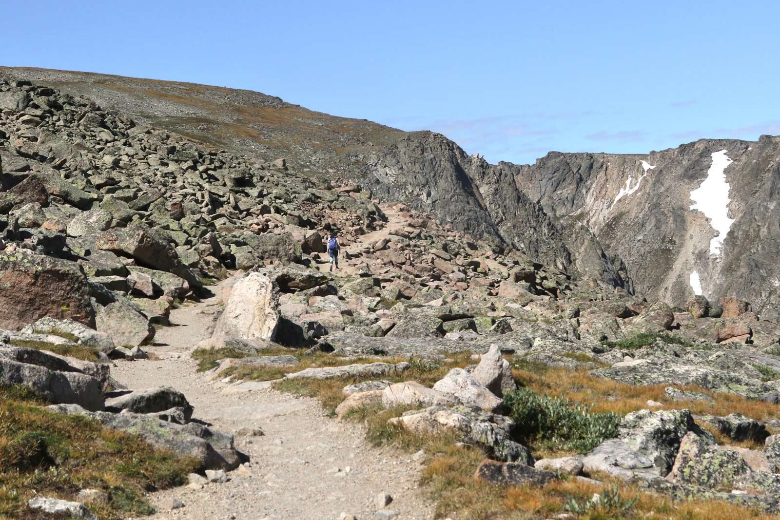
The Flattop Mountain Trail is one of the most popular hikes in Rocky Mountain National Park. It begins at Bear Lake Trailhead and is an 8.9-mile hike. Along the way, you can check out Bierstadt Lake and Mills Creek Basin. The Flattop Mountain hike is considered one of the more strenuous hikes in Colorado national parks.
The Flattop Mountain Trail was also known as the Grand Trail or the Big Trail. The trail gets more difficult the further up you go but you also get to see places few will get to see. Once you get closer to the top of Flattop Mountain the trek will flatten out and you’ll see Tyndall Glacier and Hallett Peak.
- Length of Hike: 8.9 miles /14.32 kilometers
- Difficulty: Difficult
- Parking: Bear Lake Trailhead
Continental Divide Trail
This is the mother of all trails, the Continental Divide Trail runs along Rocky Mountain National Park all the way up to Canada and all the way down to Mexico. The Continental Divide Trail is just over 3000 miles long and is a mix of wild and developed trails that is recommended for the experienced.
The portion that lies in Rocky Mountain National Park isn’t exactly on the official Continental Divide National Scenic Trail as it is officially called. But just the same, it is one of the best hikes in the park as you go above the treeline and experience the alpine tundra climate. Most people who decide to do the portion inside the park tend to make a backpacking trip of it and camp out within the park. Folks often start out at Granite Falls or from the opposite end at North Inlet Junction and make a 3 or 4-day trip of it.
The hike is rocky with many switchbacks and can be exhausting for even the most experienced of hikers. On the flip side, you’ll see all sorts of wildlife like moose and elk as well as waterfalls and alpine worlds. Do note that you need to get a permit and reserve your campsite far in advance of your trip to Rocky Mountain National Park.
- Length of Hike: 28-mile loop /45 kilometers
- Difficulty: Moderate
- Parking: Grand Lake/East Shore Trailhead
Bear Lake Trailhead
One of the easiest and best hikes in Rocky Mountain National Park has to be Bear Lake. It’s a 1/2- mile hike but there is a whole lot to see on the Bear Lake Trail in that short span. You’ll see the alluring Hallet Peak towering above as you circle the lake. As you continue you get a spectacular view of Longs Peak and Half Mountain.
You should also pull your eyes away from the sky and look directly around you. You’ll be surrounded by mile-high trees including the likes of Aspen, Pine, and Spruce. The Bear Lake hike is good for all ages but there are some steep inclines in sections that could be challenging for those with mobility issues. You can use the Rocky Mountain Park shuttle to get to Bear Lake Trailhead to start your hike.
- Length of Hike: .8 mile loop / 1.2 kilometres
- Difficulty: Easy
- Parking: Bear Lake Road – shuttles available
Moraine Park Trail
The Moraine Park Trail is considered a pretty easy trek in Rocky Mountain National Park. The trail is a 3.5-miles long round trip. You have a moderate 350-foot elevation gain. This is the perfect trail to take for the whole family. It is greater for a nice leisurely walk rather than a hike.
You can pack along a picnic and just enjoy the scenery and wildlife. You should note that this trail is used by horses more than it is by people but you get to enjoy pretty Rocky Mountain National Park views without the strain of hiking and backpacking gear.
- Length of Hike: 3.5-mile loop / 5.5 kilometers
- Difficulty: Easy
Odessa Lake
The Odessa lake hike is an 8.9 miles long round trip and is considered a moderate hike. It starts off at Bear Lake trailhead and provides a 1900 feet elevation gain. The Odessa Lake gorge spreads out in front of you in the beginning before you get really deep into the thick pine forest.
You can fish in Odessa Lake and then head back to the trailhead. Alternatively, you can continue on to experience Fern Lake Falls and exit from the Fernlake Trailhead.
- Length of Hike: 8.9 miles / 14.32 km
- Difficulty: moderate
- Parking: Bear Lake Trailhead
Emerald Lake Trail
The Emerald Lake day hike is an easy one but it will take you about 3 hours. The Emerald Lake trail sits by Estes Park and is 3.6-miles long all the way out and back. You’ll be making a 650-feet gain as you climb. You will start your hike off at the Bear Lake Trailhead which is located on Bear Lake Road. You can take the shuttle to get there.
From the trailhead, you’re going to head up to Nymph Lake, which is a small, clear lake surrounded by lilies and wildflowers. Just past Nymphy Lake is Dream Lake and it is all as idyllic as it sounds. The wildflowers and chirping birds and quiet of the early morning make you feel like you’ve traveled to another world.
You have to check out the Emerald Lake Overlook and experience Tyndall Creek winding through a gorge and providing you with mood music. Do note that Emerald Lake and Dream Lake both have some steep inclines despite the overall hike being pretty easy.
- Length of Hike: 3.6-mile loop / 5.5 kilometers
- Difficulty: Easy
- Parking: Club Lake Trailhead
Glacier Gorge Trailhead
This 5 miles out and back hike requires moderate exertion but it is recommended that you use shoes with traction. Spikes should be good enough along the trail although going towards the end of it, you might want to have snowshoes. It can get very windy at times on this Glacier Gorge trail which can amplify the cold and snow so ensure you are dressed for that.
Your elevation gain is just 872 feet but since you start out pretty high up on the Glacier Gorge Trailhead, you get some pretty sweet views. You can park at the trailhead and take it from there. Once you get to Mills Lake, you’ll feel it was all worth it as the views are both serene and stunning.
- Length of Hike: 15 miles / 9.3 kilometers out and back
- Difficulty: Easy
- Parking: Glacier Gorge Trailhead
Alberta Falls
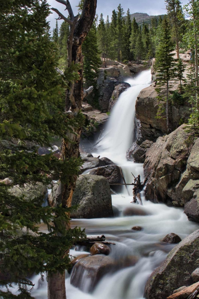
Considered one of the best waterfall hikes in the Rocky Mountains, Alberta Falls’ 30-foot drop is surprisingly quick and easy to get to. This day hike is a 1.7-mile roundtrip, which means everyone in the family can join in.
To start your Alberta Falls hike you’re going to head out to the Glacier Gorge Trailhead. It’s located on Bear Lake Road and the park shuttle can take you there. There is also parking by Bear Lake Road but it can fill up quickly since the area is quite popular.
Your Alberta Falls Hike is going to take you through fall aspens across Chaos Creek and through Glacier Creek Trail. The falls are named after the wife of one of the first settlers of the Estes Park area. Once you get to the falls you can choose between heading back down or continuing on to Mills Lake.
- Length of Hike: 1.7-mile loop / 2.7 kilometers
- Difficulty: Easy
- Parking: Glacier Gorge Trailhead
Plan Your Next Trip to Colorado With These Resources
Sky Pond
Every step of the way to Sky Pond is gorgeous, but each step you take might be a little slippery. The 8-mile hike to Sky Pond is considered a moderate to difficult hike. It can be done in regular hiking boots but it is a little steep and can also get a little slippery. That’s because there is snow and ice well into June and even into July. If you’re a little wary about steep hikes, it’s a good idea to take your poles.
You can start at Glacier Gorge Trailhead or even Bear Lake. Both starts are going to be busy and the parking lots at Bear Lake and Glacier Gorge Trailhead fill up fast so it might be a good idea to take a shuttle to the Sky Pond trail. Despite the cold temperatures when you reach Sky Pond, it is a popular place to just relax, snack, and take it all in.
Although the hike on the way up is steep, there is some fun to be had on the way down from Sky Pond. Many hikers say they slid all the way back down because it was just easier and more fun. So, there’s that to look forward to after hitting this glass and sky pond.
- Length of Hike: 8.5 miles /13.7 kilometers
- Difficulty: Moderate to Difficult
- Parking: Glacier George Trailhead
Chasm Lake
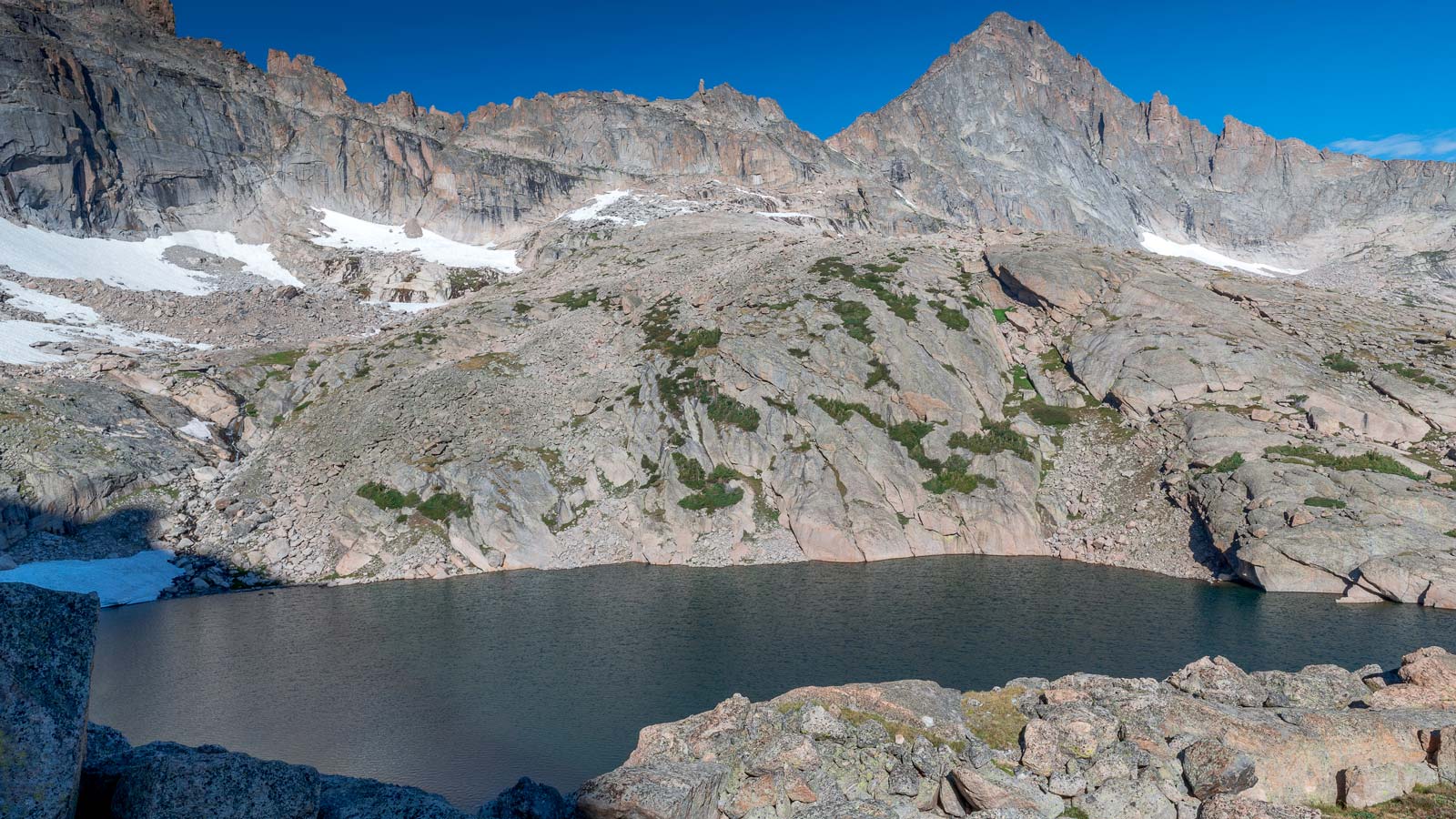
Chasm Lake will be one of the most difficult lake hikes you do in Rocky Mountain National Park, but it’ll also be one of the most rewarding. Beautiful Chasm Lake sits at the foot of Longs Peak, which is the tallest mountain in Rocky Mountain National Park. Your elevation gain will be 2566 feet and the full hike is 8.5 miles long round trip so you’ve definitely got to be prepared for this one.
Your Chasm Lake hike starts at 9,405 feet at Longs Peak Trailhead Ranger Station. You should be ready for some chilly weather and even lightning risk so dress for it. Once you get past the weather, you’re in for a treat. There are beautiful streams and meadows along with a memorable waterfall along Chasm Lake.
You will also be treated to stunning views of the Rocky Mountains lapping at each other in front of you. Chasm Lake is an out-and-back hike that isn’t is often traversed on horseback.
- Length of Hike: 8.2 miles /13.1 kilometers out and back
- Difficulty: Difficult
- Parking: Longs Peak Trailhead
Fern Lake Trailhead
If you’re determined to spend at least one night in Rocky Mountain National Park then Fern Lake might be where you want to do it. The fern lake trailhead Fern Lake Trail is a 23-mile loop trail that can even give some experienced hikers a run for their run money. That’s probably why it’s one of the less busy trails which is good news for those looking for a peaceful hike.
You can start your hike at the Fern Lake Trailhead and head into the land of alpine lakes and tundra. You’ll end up at Flat Top Mountain and likely get a chance to spot some wildlife like deer. There are three different Fern Lake campsites you can stay at but if you start early this can be a day hike. Note that along the way, you won’t find public washroom options so be prepared.
- Length of Hike: 7.4 miles / 12 kilometers Out and Back
- Difficulty: Moderate
- Parking: Moraine Park Area
Gem Lake
The Gem Lake trail is easy enough for the whole family to enjoy together. You can start your 4.4-mile journey off at the Lumpy Ridge Trailhead where there is always plenty of parking. You should note that there are some steep spots so if you’ve got any concerns about balance, you might want to think about bringing along some poles. If you start your hike early at sunrise, you’ll have the place to yourself, but if you wait until midmorning the Gem Lake trail tends to get crowded.
- Length of Hike: miles / 5 kilometers out and back
- Difficulty: Moderate
- Parking: Lumpy Ridge
Ute Trail (currently closed due to fire)
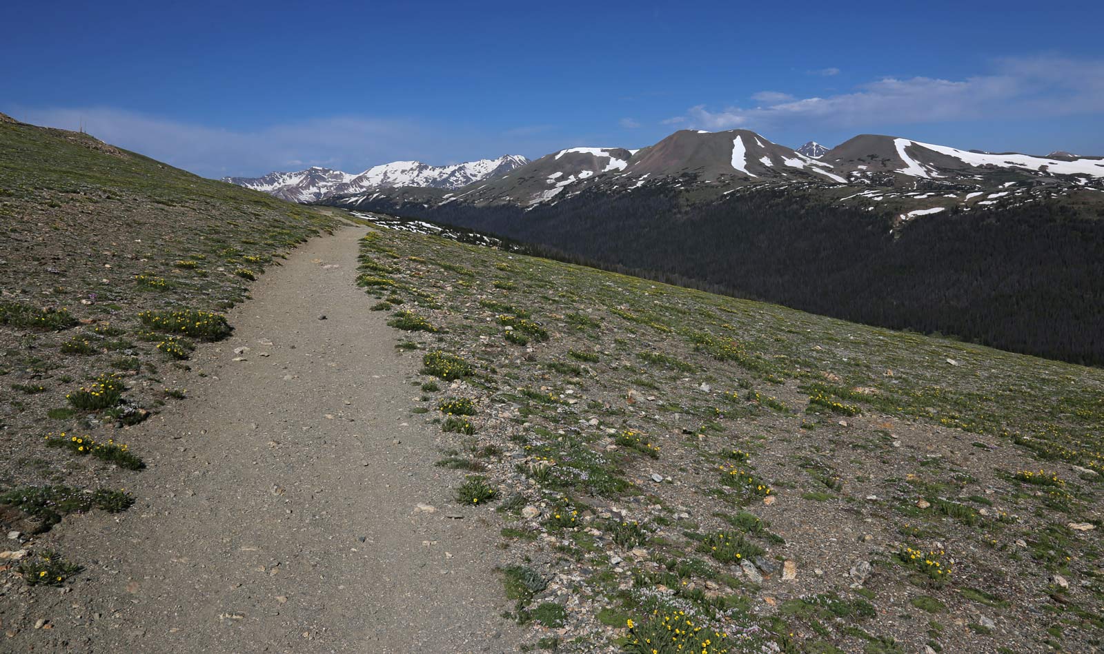
Some 11,000 feet above sea level sits Ute Crossing Trailhead. This isn’t a marked trail but you will see a small parking lot at the trailhead to begin. The trailhead begins on Trail Ridge Road which is near Rainbow Curve. Trail Ridge was a frequent route for Native Americans, including the Ute Indians, crossing the Rocky Mountains.
This is one of those very flat day hikes that is simple for everyone to do but since you’re so far up, you can experience some severe weather. There are severe winds as well as heavy sun exposure when you hike along this route as well as afternoon thunderstorms. This is alpine tundra geography so cool weather and thunderstorms should not be a surprise. Look out for ptarmigans while you’re up here.
- Length of Hike: 4 miles out and back
- Difficulty: Easy
- Parking: Ute Crossing Trailhead
Thunder Lake
To get to the Thunder Lake hike you’ll need to use Wild Basin Trailhead. You can park here and head up. The is an 11-mile trek and is considered quite difficult. Hike in Rocky Mountain can be difficult due to weather conditions but the Thunder Lake hike is difficult due to its backcountry remoteness.
Many Rocky Mountain National Park trails are crowded during the summer months but this isn’t one of them. So if you’re looking for a quiet trek, this is the one you’re going to want to check out. It is a good idea to bring along poles.
- Length of Hike: 11.6 miles / 18
- Difficulty: Difficult
- Parking: Wild Basin Trailhead
Ouzel Falls
The Ouzel Falls Hike is a 6-mile hike and is considered a moderate hike. To get there you’re going to want to use the Wildbasin Trailhead. The Ouzel Falls hike is heavily used so you might want to get there early.
Despite being a moderate hike, it is a good idea to use poles and spikes on the Ouzel Falls hike as there is lots of snow. Speaking of snow, many hikers recommend having snowshoes for at least part of the hike, but it can be done without them. The Ouzel Falls hike is slightly different than the other hikes
Whereas in other parts, you see all sorts of spectacular views of mountains like the Twin Sisters and Longs Peak, this hike is heavily forested. You will hike past Aspen Groves and more with barely a mountain view in sight until you get to the top.
- Length of Hike: 5.4 miles / 8.6 kilometres
- Difficulty: Difficult
- Parking: Wild Basin Trailhead
Tips for a Great Hike
- You should never feed Rocky Mountain National Park wildlife no matter how cute they look. You should also never gett too close to wildlife as it sets a potentially dangerous precedent.
- Be aware that altitude changes can negatively affect you, especially if you have certain health conditions.
- Make sure to pack enough healthy, salty snacks and fluids. In line with that take breaks and have those snacks and keep hydrated.
- Also, bring a map as well as a compass or a GPS for your travels in Rocky Mountain National Park.
- Don’t forget to lather on that sunscreen regardless of the time of year. The higher you climb the more exposed you’ll be. It’s also a good idea to wear sunglasses and a hat.
- Check for Rocky Mountain National Park weather updates. Weather can change quickly and it differs from area to area. The areas above the treeline are particularly susceptible to inclement weather.
- There are no pet-friendly areas within Rocky National Park and it is for your pet’s safety. There are however many places you can board your pet in nearby towns.
Explore More National Parks
- Canadian National Parks: Best Canada National Parks – That We’ve Seen
- Torres Del Paine: Torres Del Paine National Park – 5 Days In Patagonia
- Ivvavik National Park: Ivvavik National Park: Falling In Love With The Rugged And Remote
- Pukaskwa NP: The Wild Coastal Trail Of Pukaskwa National Park
- Waterton Lakes National Park: Things To Do In Waterton Lakes National Park
- Jasper National Park: Amazing Things To Do In Jasper, Alberta
- Banff National Park: Things to do in Banff