From Manitoulin Island to Milton, the best Ontario hikes take you through the rugged and beautiful landscape of the Niagara Escarpment with hikes that suit all levels and age groups. With short treks to waterfalls or epic hikes through Canada’s oldest and longest footpath, Ontario is an amazing province to enjoy the great outdoors. If you are thinking about exploring Ontario on foot, dive into our list of the best hikes in Ontario.
Table of Contents
Top Ontario Hiking Trails
The best Ontario hikes may not take you through the towering peaks of the Rockies, but they do take you through some easily accessible hiking with stunning vistas. Getting outside makes for the perfect day trip in Ontario, so let’s see where to go in Ontario this weekend.
1. Coastal Trail – Lake Superior
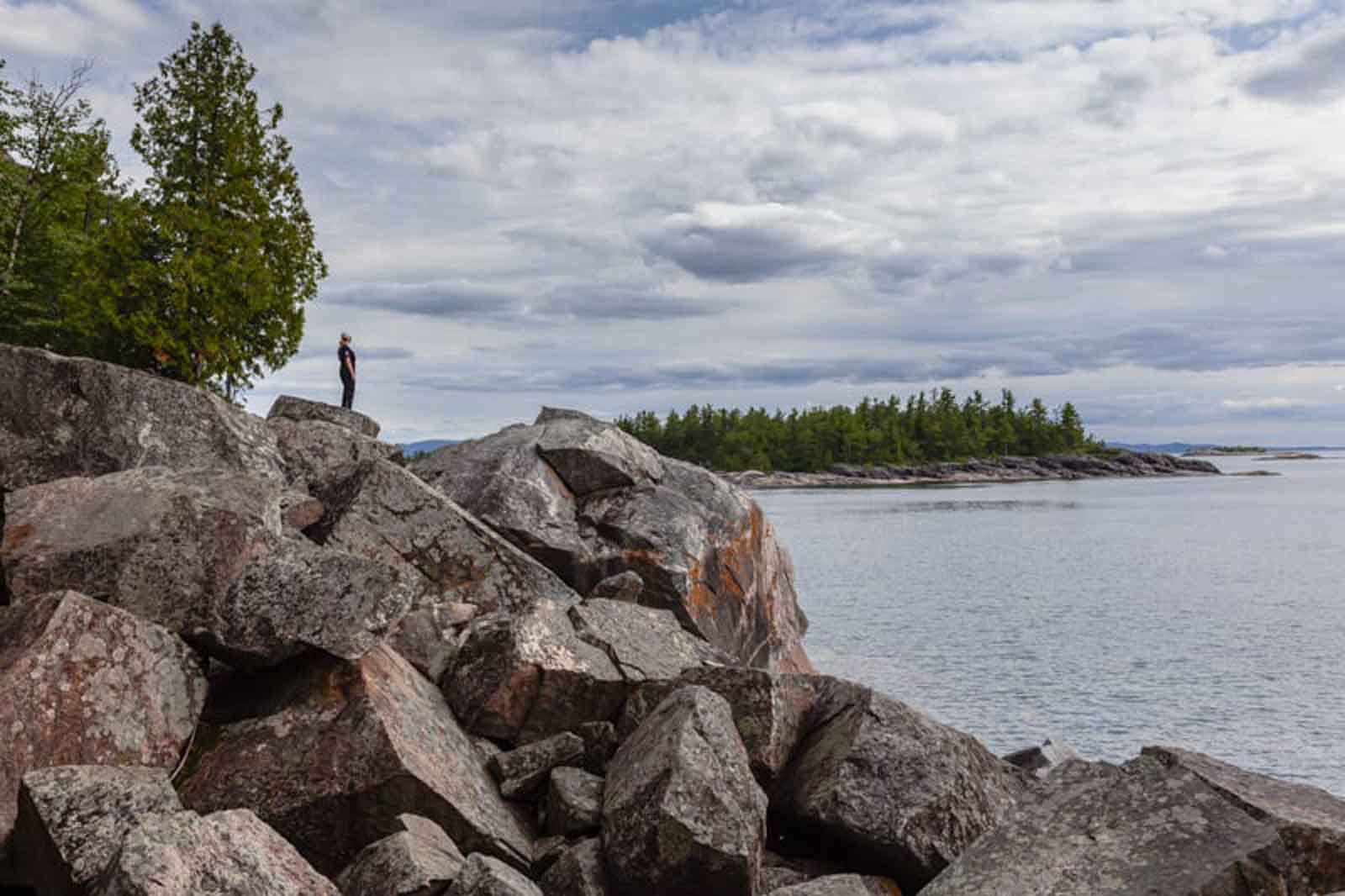
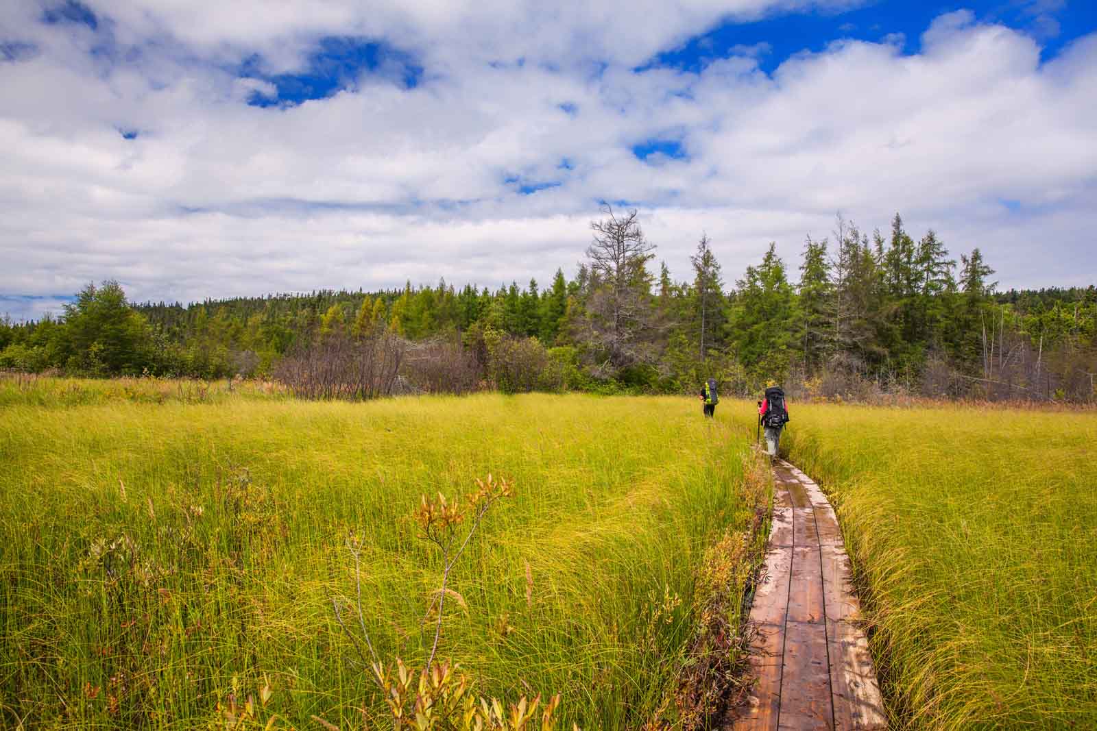
Tracing the Lake Superior coastline, this epic hike is one of the most challenging but rewarding hikes in Ontario. Within Lake Superior Provincial Park, this trek can take up to 7 days to complete. The trek starts off at Agawa Bay, making its way around Lake Superior to Chalfant Cove. The well-marked trail traverses rocky terrain to jaw-dropping cliffs, dense forest and several storybook beaches. Although there are several exit points, you will want to have a clear weather forecast to enjoy this hike end-to-end.
- Trailhead: Agawa Bay Campground
- Distance: 64.4 KM or 40.4 miles
- Difficulty: Difficult
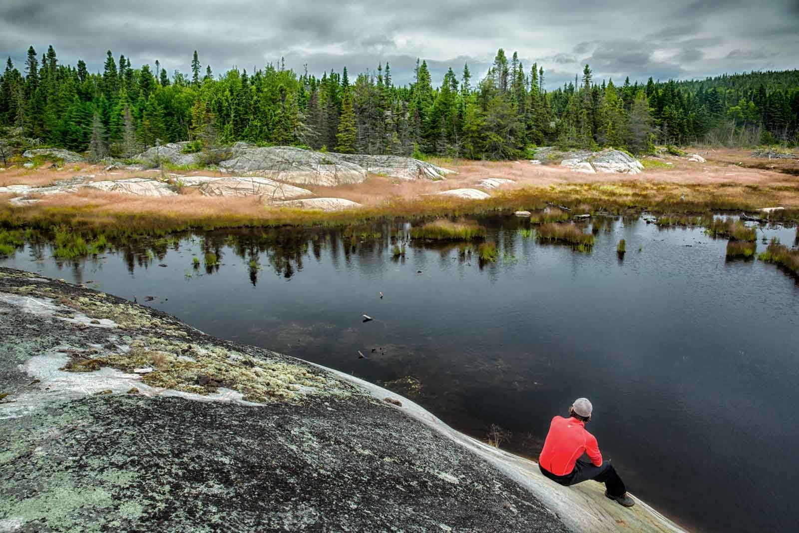
2. Pukaskwa Coastal Hike – Lake Superior North Shore
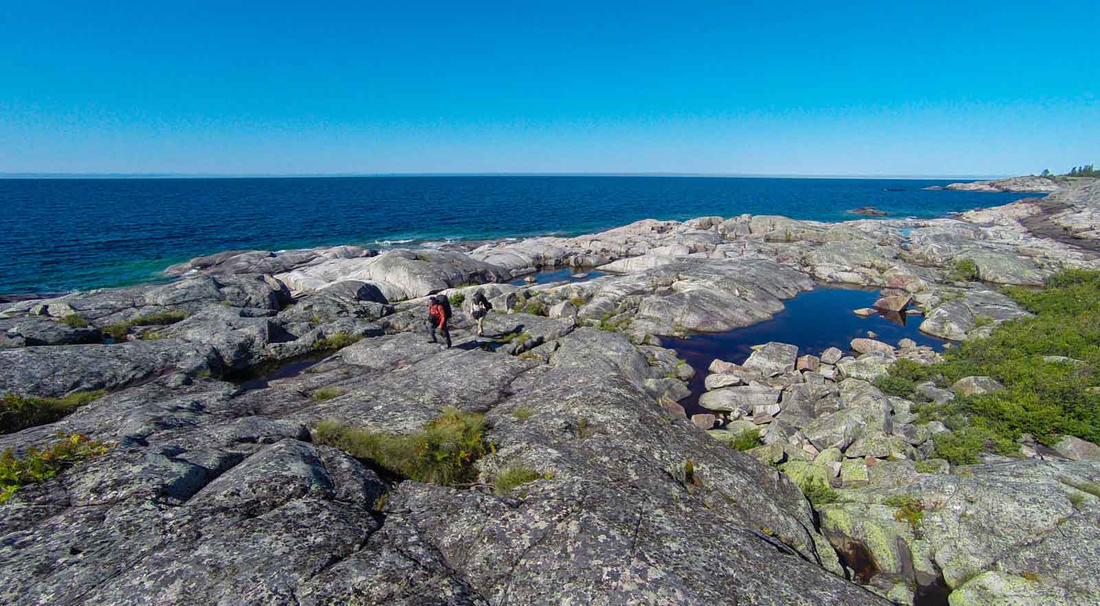
The Pukaskwa Coastal Hike is located in Pukaskwa National Park and is considered one of the most challenging hiking routes in Canada. It is incredibly beautiful and remote. The Lake Superior Coastal Trail is a 65km route that starts in Agawa Bay and ends at Gargantua Bay. It is a demanding trail that takes several days. For more on this epic coastal trail, check out our hike in Pukaskwa National Park.
The main trail ends at a beautiful suspension bridge along the White River Suspension Bridge Hiking Trail that will take you back to the national park visitor centre. The hike can take anywhere from four to seven days. This is one of our favourite hikes in Ontario, and we highly recommend it for anyone wanting a challenge beyond a day trip.
- Trailhead: North Swallow (boat shuttle from parks headquarters
- Distance: 60 km (37 miles)
- Difficulty: Difficult
3. Cup and Saucer Trail – Manitoulin Island

Few know that the amazing geology of the Niagara Escarpment continues well into northeastern Ontario. In fact, it helped create the stunning view from the highest point along the Cup and Saucer Trail.
Beginning at the Cup and Saucer trailhead, you will have two options: the 3.4-mile White Trail or the 4-mile Blue Trail. Depending on your time, complete one or both. There are several other trails on Manitoulin, but if you only have time for one, this is the perfect trail to offer a glimpse of everything.
Either way, you will enjoy stunning views of the Manitoulin Island cliffs as you stand high above the hardwood forest. For more tips on what to do on Manitoulin Island, click here.
- Trailhead: Highway 540 and Bidwell Road
- Distance: 12 km or 7.5miles combined
- Difficulty: Moderate
- Elevation Gain: 479ft
4. Stubb’s Falls Trail – Arrowhead Provincial Park

From an all-time epic trek to one of the prettiest waterfall hikes in Ontario, the adventures keep coming. You can put on your running shoes for this trek with a series of rewarding short uphills on your way to Stubb’s Falls. The falls provide the perfect opportunity to have a picnic with friends and family or some quiet nature time with your partner. The ease of the trek, compared to many others on this list, also creates an opportunity to get the young ones out into nature. Arrowhead Provincial Park is a scenic 2.5-hour drive north of Toronto.
- Trailhead: Arrowhead Park
- Distance: 2km or 1.24 miles
- Difficulty: Easy
- Elevation Gain: 229ft
5. Mizzy Lake Trail – Algonquin Provincial Park
It is suggested that you get out early to enjoy the Mizzy Lake Trail to its fullest. This hike is within Algonquin Provincial Park, the king of Ontario Parks. Along the journey, you will pass nine ponds and a series of small lakes, making this trail one of the most picturesque hiking trails in Ontario.
As you come to the north end of Mizzy Lake, the path changes to a boardwalk that carries you to a section frequented heavily by wild animals, including moose and otters. It’s a bird watchers’ paradise. This is why it’s best to be up early to increase your opportunities to spot wildlife. From there, turn into the boreal forest on your way back to the trailhead.
- Trailhead: Highway 60 – Arowhan Road
- Distance: 11.1 km (6.8 miles)
- Difficulty: Moderate
6. Pines Hiking Trail – Atikoken
As the name suggests, the Pines Hiking Trail presents trekkers with giant, ancient pines. The kind that makes you sit back and realize how small you are. Over the course of the hike, you will have many opportunities to admire the towering trees. But you should also maintain a steady pace in order to reach Pickerel Lake. Here, you will find an excellent picnic spot with gorgeous views.
Once you have completed the moderate hike that offers some short, steep climbs, the fun doesn’t end there. You will be able to hike a further 1.5 miles along the popular Whiskey Jack Trail.
- Trailhead: Dawson Trail Campground
- Distance: 10 km (6.2 miles)
- Difficulty: Moderate
- Elevation Gain: 288ft
7. Bluff Trail – Awenda Provincial Park

The ancient glacial landscape found within the Awenda Provincial Park is the setting for one of the best Ontario trails. The Bluff Trail leads you through old-growth forests before guiding you to the top of Nipissing Bluff. A sandy beach that quickly rises to 197ft above.
Although a trail with minimal elevation gain, the length of the Bluff Trail makes it a moderate trek. But all the effort will be worth it with the chance to birdwatch and get amazing views of Georgian Bay. While in the fall, auburn leaves coat the path.
Along the path, many trails link up, providing ample opportunity for day trips further into Awenda Provincial Park.
- Trailhead: Awenda Park Road
- Distance: 13km or 8.1 miles
- Difficulty: Moderate
- Elevation Gain: 620ft
8. Silver Queen Mine Trail – Murphy’s Point Provincial Park
Short, sweet, and historic is how you would sum up the impressive Silver Queen Mine Trail. Despite being just over a mile in length, it is one of the best hiking trails in Ontario.
This well-maintained trail leads you to a historic mica mine that was a major part of the local community in the 20th century. The mine remains partially operational today but is best explored by hiking. Old and young alike will enjoy exploring the restored bunker house that once held the mine’s workers.
Importantly, as it is not a challenging hike, this trail is perfect for families wanting to put an outdoor activity on their Ontario itinerary.
- Trailhead: Lally Homestead Parking Lot
- Distance: 2km or 1.2 miles
- Difficulty: Easy
- Elevation Gain: 22ft
9. Fire Tower Trail – Restoule
Put on your hiking boots for a little bit of everything along the Fire Flower Trail. This day hike will lead you through boreal forest, across simple boardwalks, and also rugged trails. As you meander around Amber Lake, you will enjoy intermittent views of the beautiful lake. But as tempting as it would be to stop, the views will continue to get better.
Eventually, you will pass the historic fire tower, which gave the trail its name. From there, you will embark on a short but challenging climb to a stunning viewpoint. Atop Stormy Lake Bluff, you will see well beyond the sparkling lake and the old-growth forest.
- Trailhead: Dawson Trail Campground
- Distance: 10km or 6.2 miles
- Difficulty: Moderate
- Elevation Gain: 288ft
10. La Vigilance Trail – René Brunelle Provincial Park
Combing beautiful scenery and a splash of history along this hiking trail. Starting within the René Brunelle Provincial Park, the trail is well-maintained and a perfect trek for all skill levels.
After a couple of miles, you will arrive at a viewpoint that presents views of Airplane Island. Created as a base for airplanes in the 1920s, Airplane Island helped fight forest fires within Ontario Parks and around the province.
Along the way, you will also find details of a tragic plane crash that occurred two years after the base opened in 1922.
- Trailhead: Provincial Park Road
- Distance: 4.9km or 3.1 miles
- Difficulty: Easy
- Elevation Gain: 200ft
11. La Cloche Silhouette Trail – Killarney Provincial Park

Arguably one of the most strenuous hikes in Ontario, the iconic rugged trail is a circuit of the province’s La Cloche Mountains. For those up to the challenge, you will be well rewarded over the 7-day journey.
Beginning within Killarney Provincial Park, the challenging trail takes you deep into the wilderness. Keep an eye out for nature, with the opportunity to spot bald eagles.
Not everyone will arrive with the necessary gear to tackle one of the hardest Ontario hikes. However, with the help of Killarney Outfitters, you can enjoy exceptional gear and help planning the trip.
- Trailhead: George Lake Campground
- Distance: 100km or 62 miles
- Difficulty: Difficult
- Elevation Gain: 7549ft
12. Top of the Giant Trail – Thunder Bay
For the adventurous soul, The Top of the Giant Trail is located in Ontario’s Sleeping Giant Provincial Park and is renowned as one of the best hikes in the province. Located an hour outside Thunder Bay, you can actually see the sleeping giant from town.
This challenging yet rewarding trail spans approximately 22 kilometers on a round trip, and the hiking time typically takes about 6 to 10 hours to complete, depending on your pace and stops along the way.
The trailhead begins at the Kabeyun Trail parking lot, and the journey initially follows the Kabeyun Trail before branching off onto the Talus Lake Trail and finally ascending the Top of the Giant Trail.
Hikers are treated to an array of stunning natural scenery, including dense forests, rocky terrains, and serene lake views. The pinnacle of the hike offers breathtaking panoramic views from the top of the giant’s “head,” overlooking the vast expanse of Lake Superior and the surrounding wilderness.
After completing the Talus Lake section, you will have a steep 3km (1.7-mile) hike to the dizzying views of Lake Superior. This trek is for experienced hikers because of the steep climb. Be sure to bring plenty of water and a first aid kit for this remote trek.
The good news, however, is you can enjoy mountain biking at the end of the scenic and flat Kabeyun Trail.
13. Ishpatina Ridge Tower Summit
Ishpatina Ridge Tower Summit Trail is a must-hike destination at the highest point in Ontario. The trailhead is at the end of the logging road off Red Squirrel Road, and the round trip is 18 km. Hiking time is 6-8 hours.
This challenging trail gives you a variety of landscapes, dense forests, rocky sections, and lake shores. As you go, you’ll see the Canadian Shield, unique rock formations, and greenery. The highlight of the hike is the summit of Ishpatina Ridge, where a fire tower once stood. From here, you’ll have views of the wilderness, the forests, and lakes that dot the landscape.
14. Bruce Trail – Niagara to Tobermory
Beginning on the US-Canada border in Niagara Falls and running all the way to Tobermory, the Bruce is one heck of an adventure trail. All counted, the hike covers 885 km (550 miles). If you are up for the adventure, a thru-hike takes roughly 30 days to complete.
The Bruce Trail is Canada’s oldest and longest footpath, taking you through thick forest, rolling countrysides, and up to huge boulders and cliffs. If you hike from end to end, make a note that camping is not possible in the entire section. You can check the Bruce Trail Conservancy for great accommodations at each section of the trail.
- Trailhead: Queenston – Tobermory
- Distance: 885 km (550 miles)
- Difficulty: Moderate
15. Sections of the Bruce Trail
For us mere mortals, the trail is broken up into sections, and most people tackle the Bruce Trail on day hikes. Some of our favorite sections of the Bruce Trail are around Hamilton and Milton or Tobermory and Collingwood. But you can’t go wrong with any section of the Bruce Trail. Hamilton has some of the best waterfall hikes in Ontario, while Tobermory has some of the best views in Ontario. Check out all the trail sections here.
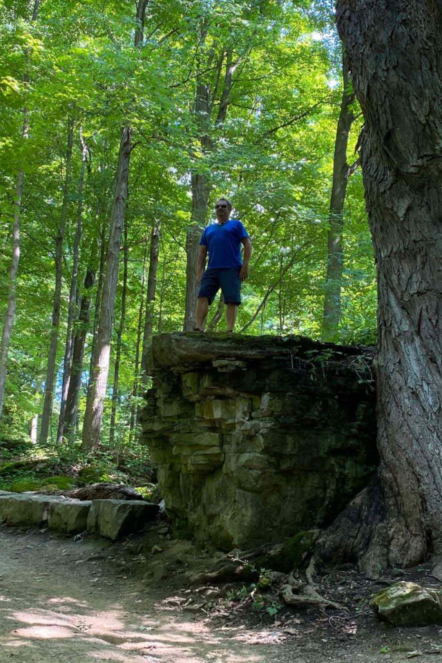
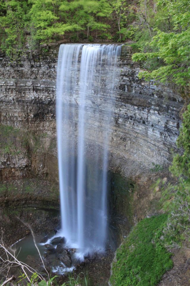
16. Dundas Peak Trail – Hamilton
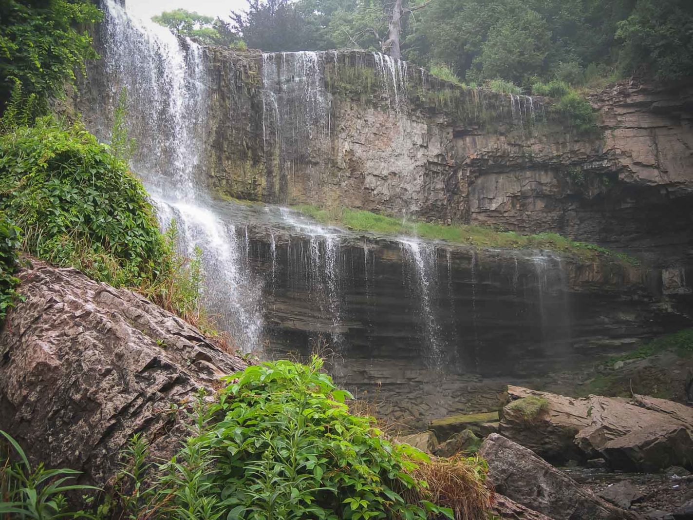
One of the best hikes to do in the fall is the day hike to Dundas Peak. Just an hour out of downtown Toronto is where you will find Spencer Gorge Conservation Area. The trail begins here and winds along the Niagara Escarpment beneath the heavy mixed forest. With the sun poking through the orange canopy, the hike is a sight to behold.
But what makes the Dundas Peak Trail one of the favorite hikes among locals is the multiple waterfalls it passes. Along the way, you will cross Webster and Tews Falls. The trails lead to a beautiful lookout.
- Trailhead: Tews Falls Lookout Trail
- Distance: 3.9km or 2.4 miles
- Difficulty: Moderate
- Elevation Gain: 360ft
17. Barron Canyon Trail
Within the iconic Algonquin Park, you will have an abundance of hiking options to choose from. If you are short on time or prefer something easy, then trek down the Barron Canyon Trail. What it loses in length, it gains with spectacular scenery and offers hikers one of the best lookouts in Algonquin Park. A ledge that hangs 330 ft above the Barron River and offers far-reaching views of the park.
- Trailhead: Barron Canyon Road
- Distance: 1.6 km (1 mile)
- Difficulty: Easy
18. White River Suspension Bridge Hiking Trail
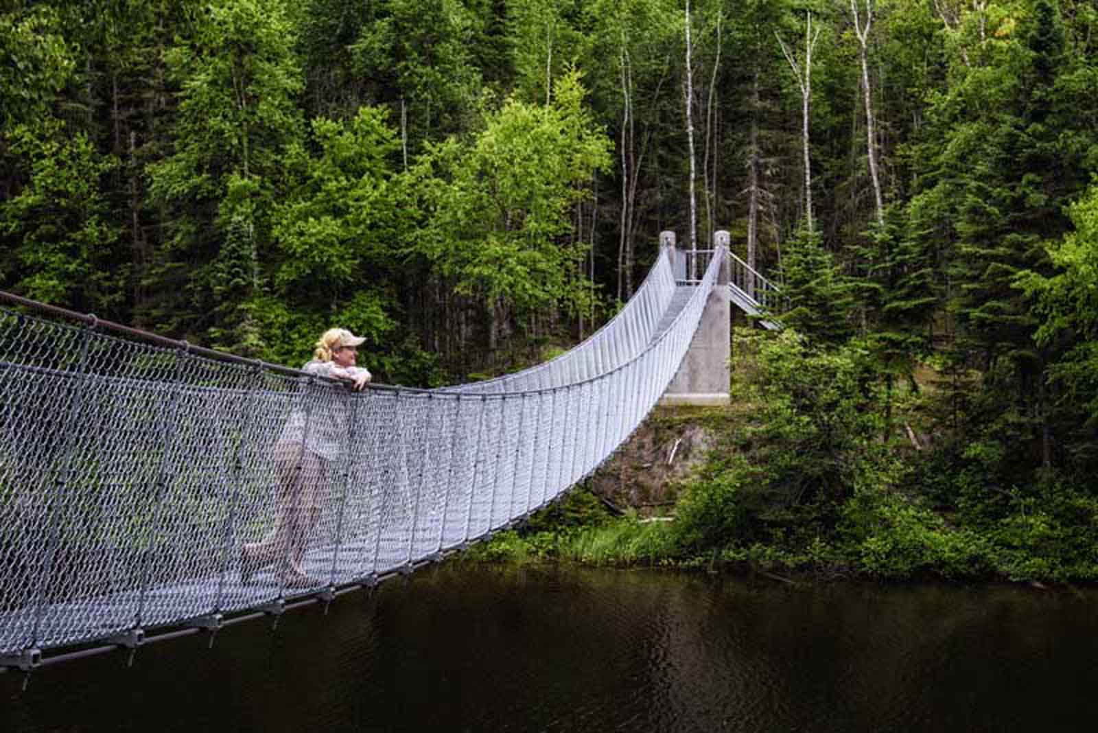
No list of Ontario hikes would be complete without mentioning the renowned White River suspension bridge. This long-day trip will take you deep into thick forests, wetlands, and the Canadian Shield. About halfway down the trail, you will arrive at a secluded beach within Playter Harbor. Grab a snack and enjoy the views before continuing on.
The bridge has to be seen and believed. Standing 76ft above Chigamiwinigum Falls and spanning almost 100ft, it is an unforgettable trip across.
- Trailhead: Hattie Cove Campground
- Distance: 18 km or 11.2 miles
- Difficulty: Moderate/Difficult
19. Lake of the Woods Trail – Killarney
The Lake of the Woods Trail in Killarney offers an exceptional hiking experience, beginning at the George Lake Campground and culminating at the serene shores of Lake of the Woods. This moderate 3.5 km loop trail has a hiking time of about 1.5 to 2 hours to complete.
Hikers will be treated to a variety of picturesque landscapes, including lush forests, rocky outcrops, and tranquil lakeside views. The trail also offers opportunities to spot local wildlife, such as beavers, deer, and numerous bird species. Along the way, hikers can enjoy panoramic vistas of the La Cloche Mountains, known for their distinctive white quartzite peaks, making this trail a must-do for nature enthusiasts exploring Ontario.
- Trailhead: George Lake Campground
- Distance: 3.5 km or 2.1 miles
- Difficulty: Moderate
Where can I hike in southern Ontario?
A trip to Algonquin or into northern Ontario may be tricky if you are short on time. Luckily, there are many rewarding trails in southern Ontario, close to Toronto and Ottawa.
Hamilton, London, and Milton have several preserves and parks that are excellent for hiking. Many connect with the Bruce Trail. The trek to Rattlesnake Point near Milton is a local favorite and great for kids.
Check out our article on the best things to do in Hamilton.
What is the longest trail in Ontario?
The longest trail in Ontario, as well as the oldest, is the Bruce Trail. The trail is 885 km (550 miles) long and generally involves 30 days of hiking. The trail follows the edge of the Niagara Escarpment, one of thirteen UNESCO Biosphere Reserves in Canada. Along the Bruce Trail, you will find over 400 km (250 miles) worth of side trips. If you really want a challenge, you can try to complete the Bruce Trail in record time. The first record was set in 1995 at 14 days.
Ontario Provincial and National Parks
Ontario is a hiker’s dream with more than 330 Ontario parks, from remote and backcountry to accessible parks with picnic spots, mountain biking trails, and facilities. With more than 8000 campsites in the province, you can extend your Ontario hikes beyond a day trip and make a weekend out of your outdoor adventure.
The province of Ontario has a fantastic array of single and multi-day treks to experience. Many are close to major cities like Toronto and Ottawa. A quick trip in the car is all it takes.
But if you have time to explore further afield, you will find an untouched wilderness. One shaped by the raw power of ice moving for centuries on end and eventually washed away.
Hiking trails in Ontario are well-marked and easy to follow. Overnight camping is prevalent, and it is easy to book outside of Algonquin. So, with all that in mind and a cheat sheet to the best Ontario hikes, it’s time to get outdoors!
Want to know more about treks around Canada? Check out our guide on the top hikes in Canada.
Ontarians love to hike, so much so that they the town of Haliburton throws the largest hiking festival in Canada. You can read more in our guide on the best things to do in Haliburton.
There are so many places to hike in Ontario that we have barely scratched the surface. Where is your favorite hiking trail?
- Read more about Ontario Travel


Very informative list. Thanks!