Canyonlands National Park offers some of the best hikes in the United States. The largest of Utah’s Mighty Five national parks, it has miles of desert hikes, slot canyons, and panoramic views. Want to spend a day on world-class hiking trails? We recommend choosing Canyonlands National Park for your next outdoor adventure.
Table of Contents
Top Hikes in Canyonlands National Park
Of course, you’ll probably have to prioritize and pick just a few Canyonlands hiking trails on your trip. So, what are the best hikes in Canyonlands National Park? We’ll cover the best Canyonland hikes alongside some extra trails that you can hike nearby.
Without further ado, these are the best hikes in and around Canyonlands National Park.
1. Grand View Point Trail, Island in the Sky
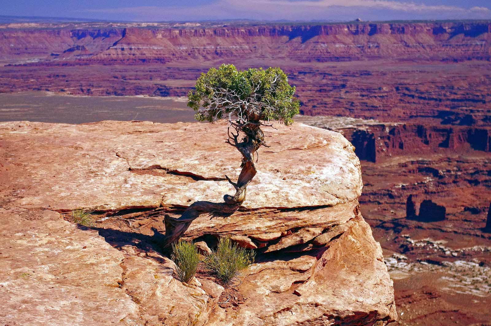
Whoever said that nothing good in life comes easy is sorely mistaken. Grand View Point is one of the easiest but best hikes in Canyonlands National Park.
The 2.9km walk takes less than an hour to complete and has a minimal elevation gain. Plus, for a marked section of the route, the path is concrete and accessible for wheelchairs and pushchairs. Wheelchair users and families can reach the first overlook point, getting fantastic views of the surrounding Canyonlands terrain on a slightly shorter route.
If you can continue to the final overlook, we’d recommend it. Standing on the edge of the Island in the Sky, you are rewarded with the White Rim Canyon and Green River views. Grand View Point Trail is a particularly popular sunset hike. The red landscape is a spectacular view in the evening.
For an even better view of this area, you might want to jump on this super popular Helicopter flight which gives you a great look at this landscape from the sky.
- Distance: 2.9km
- Difficulty: Easy
- Elevation gain: 49m
- Trailhead: Grand View Point Rd
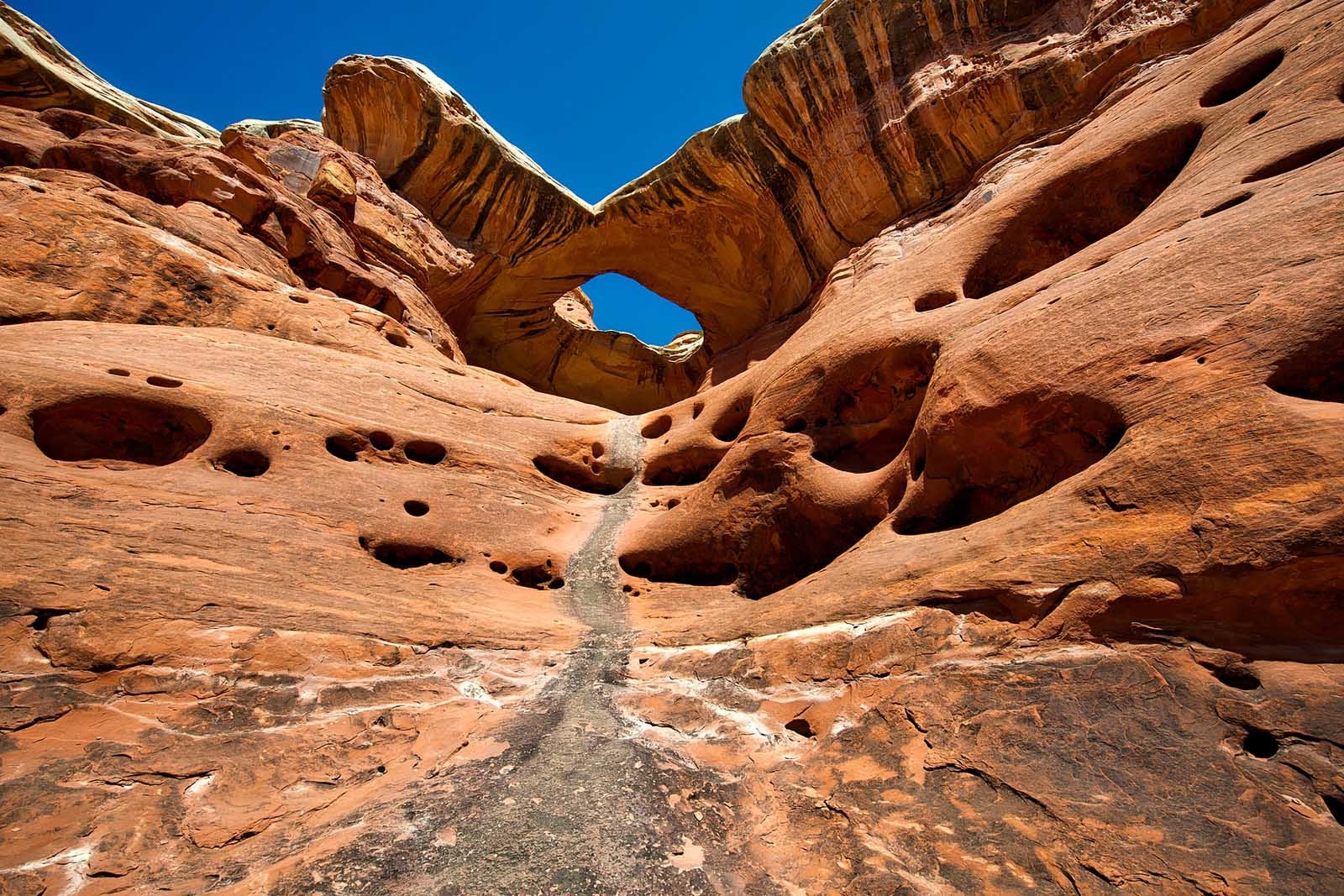
2. Mesa Arch Trail, Island in the Sky
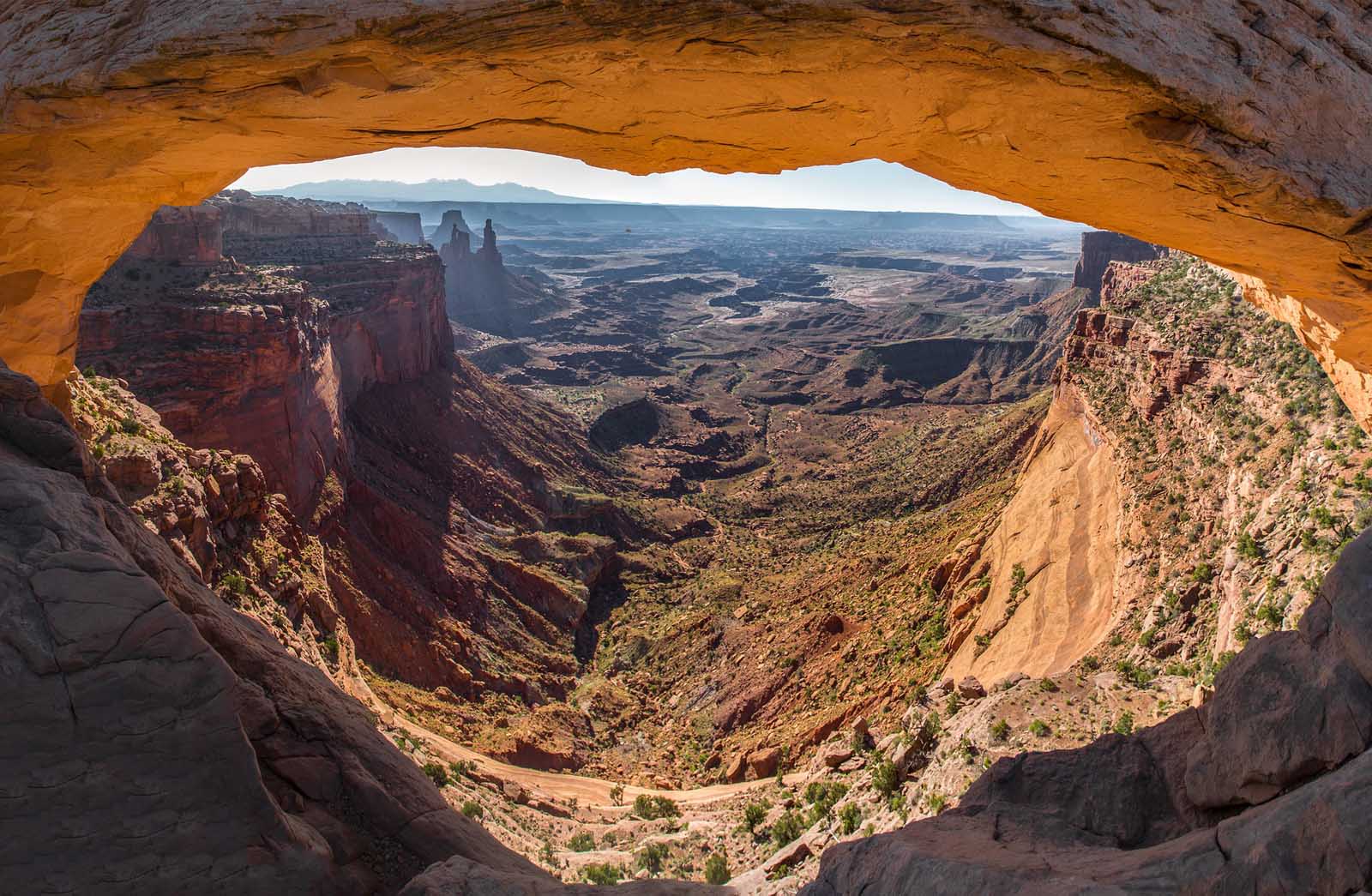
Another short but sweet addition to our Canyonlands hikes, the Mesa Arch Trail requires minimal effort but offers a high reward.
This 1.1km trail takes less than 30 minutes to complete and rewards hikers with Canyonlands’ most famous rock formation – Mesa Arch. Located in the Island in the Sky district, the views through the Mesa Arch are picture-perfect. The pothole arch frames the surrounding desert and canyon scenery, with the La Sal Mountains in the distance.
The only warning we have for the Mesa Arch Trail is that it gets extremely busy. The Mesa Arch is a high-profile attraction, so it understandably attracts lots of visitors. To overcome this minor downside, we suggest making the short hike at sunrise. It will be cooler, slightly quieter, and beautiful at this time of day. What’s not to love?
The Mesa Arch trailhead starts from the parking lot near the Island in the Sky Visitor Center. Once you’ve completed the short hike, you can easily visit other nearby overlooks on the Sky Mesa. The Green River Overlook, Candlestick Tower Overlook, and Aztec Butte are all just short drives away.
- Distance: 1.1km
- Difficulty: Easy
- Elevation gain: 27m
- Trailhead: Parking lot, Island in the Sky Visitor Center
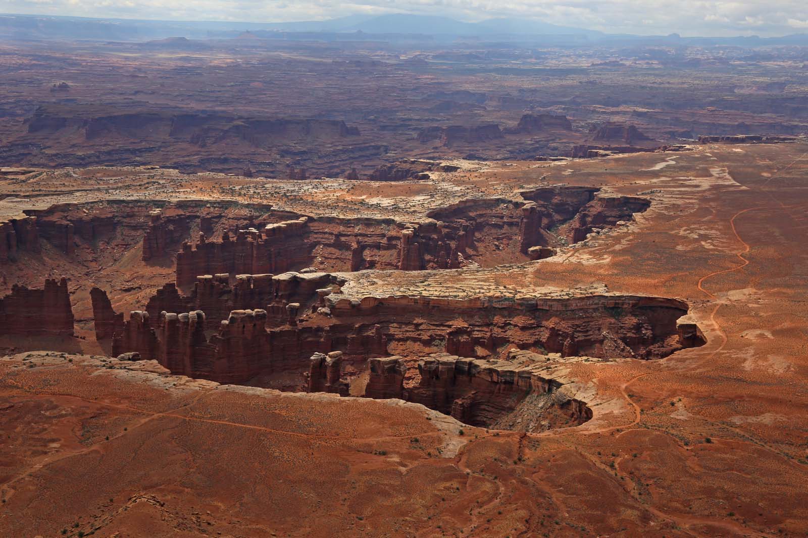
3. Chesler Park Loop Trail, Needles
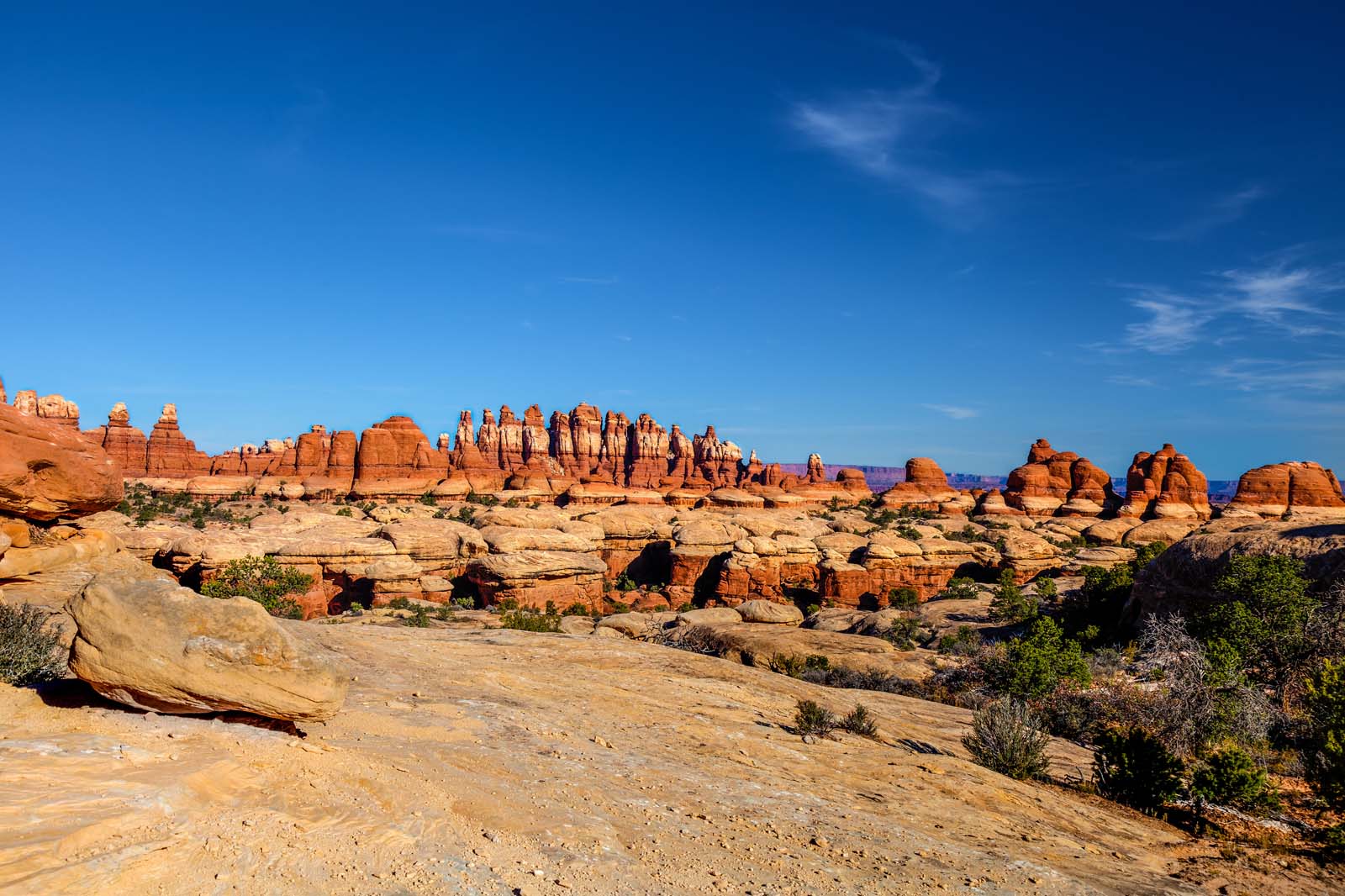
Remember your hiking boots for this trail. The Chesler Park Loop is a 16.7km moderate hike with slot canyons and rough tracks to follow. Chesler Park Loop Trail is ideal if you love scrambling and getting an off-the-beaten-track experience.
You start at Elephant Hill trailhead and join the Slickrock foot trail, following the rough path as it changes terrain from boulders to stairs and to sand-bottomed slot canyons. The route takes an average of five hours to complete, so bring a picnic lunch and plenty of water. You’ll pass impressive rock formations and get panoramic views of Canyonlands National Park’s Needles District – so bring a camera.
As the terrain feels otherworldly and unnavigable in sections, it is best for confident hikers that will arrive prepared and ready to actively navigate.
- Distance: 16.7km
- Difficulty: Moderately challenging
- Elevation gain: 555m
- Trailhead: Elephant Hill Trailhead, Elephant Hill Rd
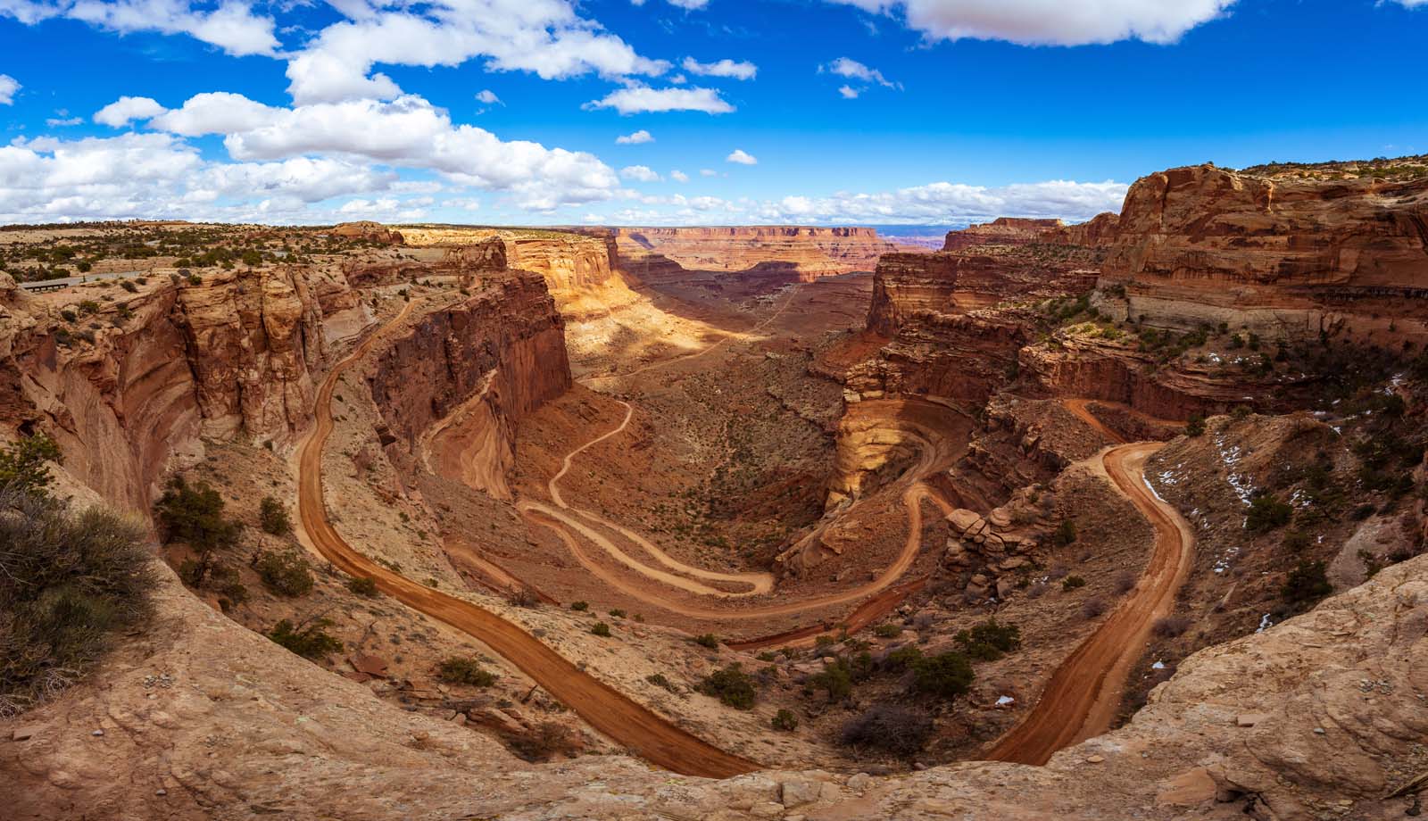
4. Syncline Loop Trail, Island in the Sky
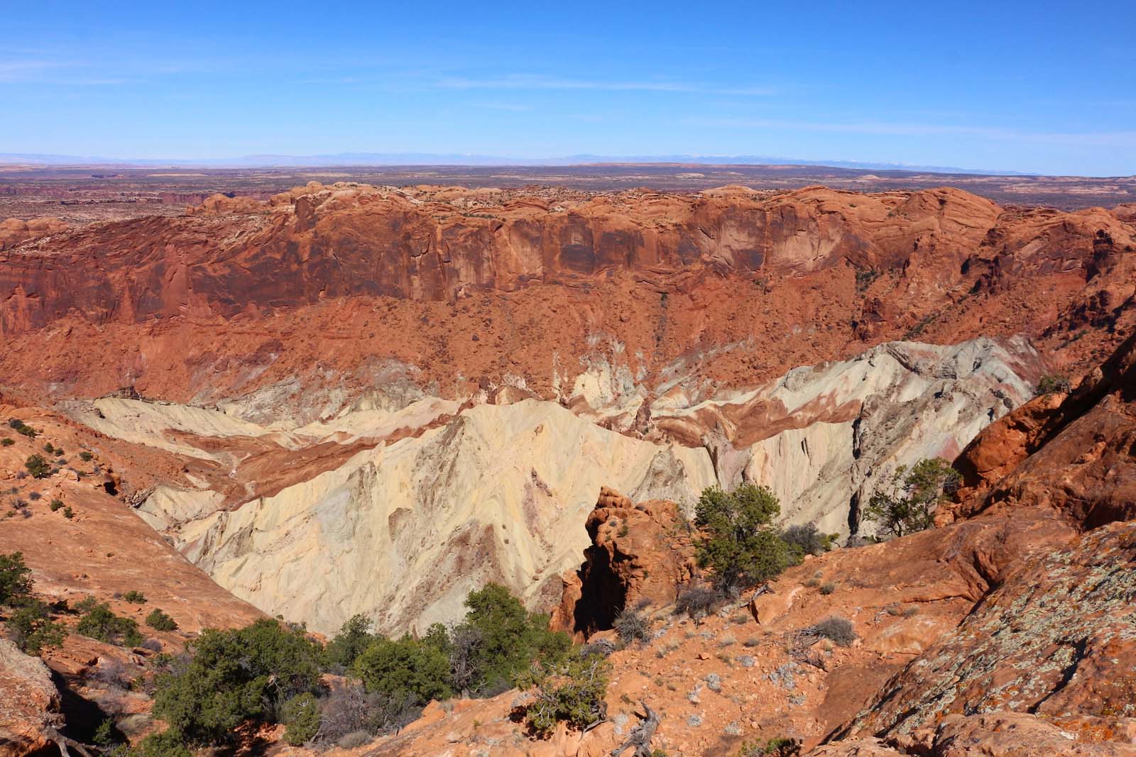
Up for a challenge? The Syncline Loop Trail will give you one. The Syncline Loop is a physically challenging 13.8km trail. It is very poorly maintained, and some go as far as to label it as primitive.
So, if this trail is so difficult, why bother? Simple. The Upheaval Dome was created by a giant meteorite crashing into Earth, and who wouldn’t be interested in that. The Syncline Loop Trail (aka the Upheaval Dome Trail) has signs at the trailhead plastered with warnings from the US National Park Service. But, as long as you are an experienced hiker and arrive prepared, you can visit the Upheaval Dome safely.
The Upheaval Dome trailhead is called ‘Syncline Loop Trailhead’ on Google Maps and can be found at the end of Upheaval Dome Road. Most hikers tackle this trail clockwise, opting for a steep initial descent rather than a strenuous ascent at the end. The route terrain is varied, and in some sections, you’ll be walking on the Upheaval Canyon edge. You’ll also cross dry waterfalls, a boulder field, and squeeze through gaps in rocks that you had no idea that you could even fit through. Luckily, the Upheaval Dome is worth it.
- Distance: 13.8km
- Difficulty: Difficult
- Elevation gain: 497m
- Trailhead: Syncline Loop Trailhead, Upheaval Dome Rd
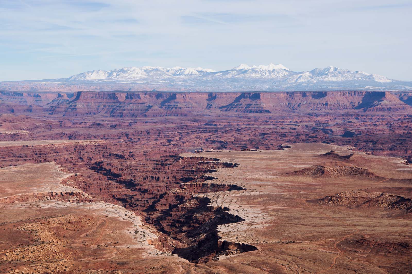
5. Confluence Overlook Trail, Canyonlands Rivers
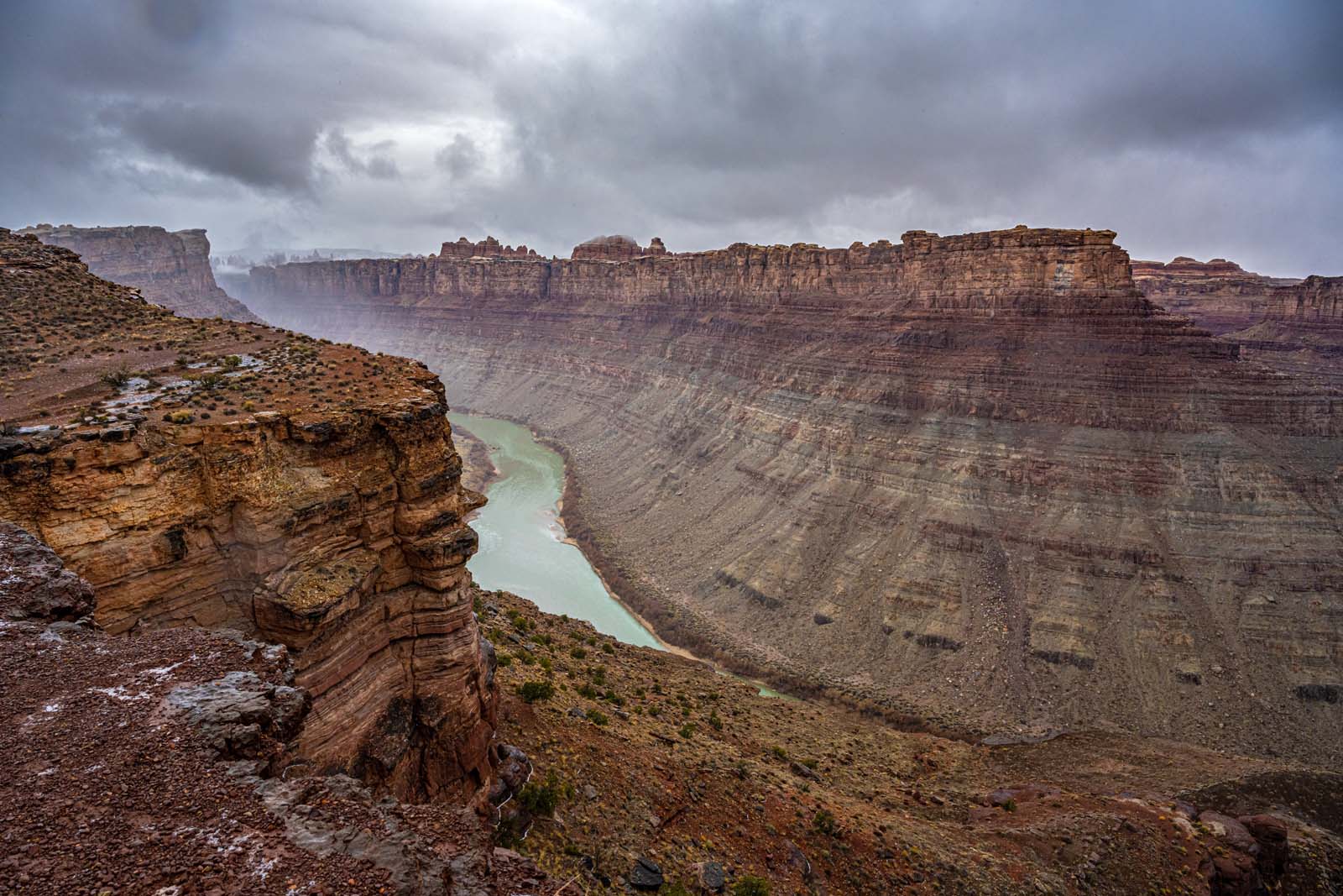
The Confluence Overlook Trail is one of the best hikes in Canyonlands National Park. The 16.1km trail is strenuous, but it incorporates a stunning overlook at the point where the Colorado and Green rivers merge.
The Colorado and Green rivers are the two major bodies of water in Canyonlands National Park. If you are an adventure sports fan, you’ll be familiar with the rivers because of all the white water rafting opportunities – especially around Cataract Canyon. Seeing the rivers merge is massively rewarding, and you can clearly see the different colors mixing together. The Green River is a pale green, and the Colorado River a tan color at their merging point.
The route is scenic and engaging throughout, with canyons to climb and spectacular, sweeping national park views. The trail takes an average of five hours to complete, so bring food and water.
- Distance: 16.1km
- Difficulty: Moderately challenging
- Elevation gain: 418m
- Trailhead: Big Spring Canyon Trailhead, Rd 211
6. Slickrock Foot Trail, Needles
If the Confluence Overlook Trail sounds a bit too much, but you still want to explore the Needles District, we recommend Slickrock Trail.
Slickrock Trail is one of the best hikes in Canyonlands when you are short on time as it only takes an hour to complete. The 3.9 km loop has four viewpoints and, thanks to its length, is a fantastic entry-level hike in the National Park.
Think of Slickrock Trail as a medium effort, excellent reward hike. Be prepared for some unmarked sections and fallen trees to scramble but otherwise, expect a laidback and untechnical walk.
- Distance: 3.9km
- Difficulty: Moderate
- Elevation gain: 42m
- Trailhead: Slickrock Foot Trailhead, Rd 211
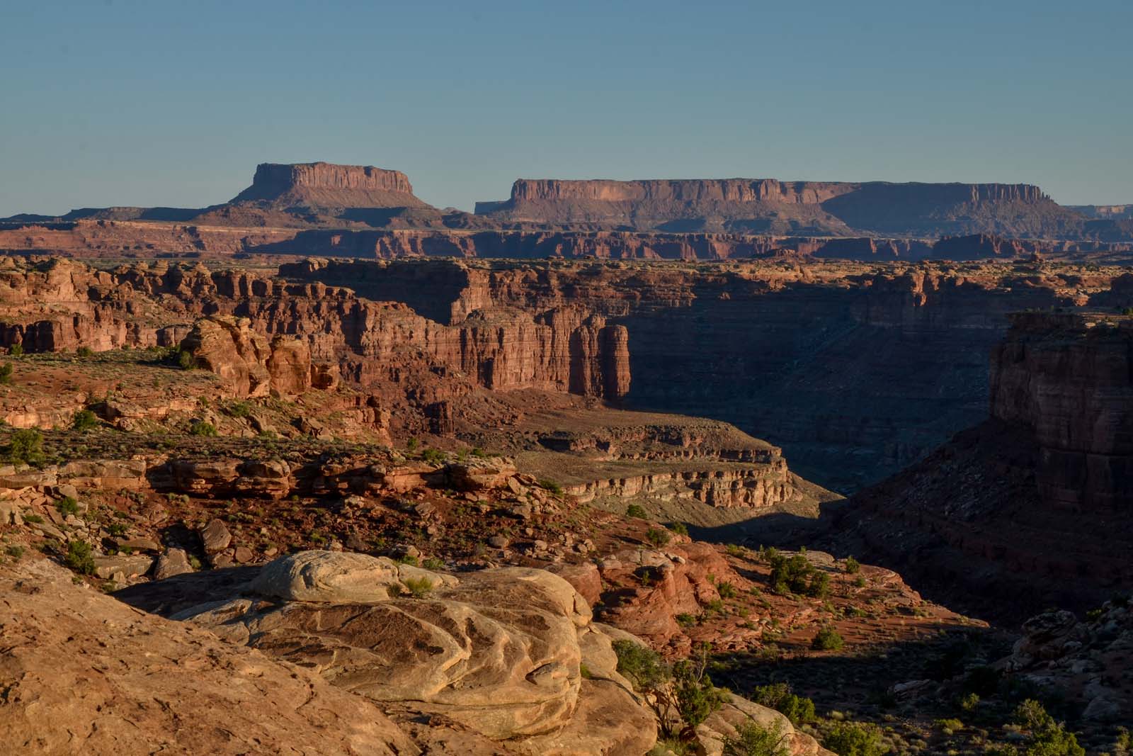
7. Murphy Point Trail, Island in the Sky
Murphy Point Trail is another short addition to our Canyonlands National Park hikes. The trail’s highlight is the end promontory, Murphy Point Overlook, which provides views of surrounding canyons and the Green River. At 5.5km, the out-and-back trail is short and easy, taking a little over an hour for most hikers to complete.
The route follows the west side of the Island in the Sky and the canyon rim. It has easy terrain, and the route gains very little elevation, so it is a perfect laidback trail if you don’t want to exert yourself too much.
These characteristics make Murphy Point Trail an excellent sunset hike in the Canyonlands National Park. Short, untechnical, and scenic, Murphy Point is well worth noting down.
- Distance: 5.5km
- Difficulty: Easy
- Elevation gain: 45m
- Trailhead: Murphy Trailhead, Grand View Point Rd
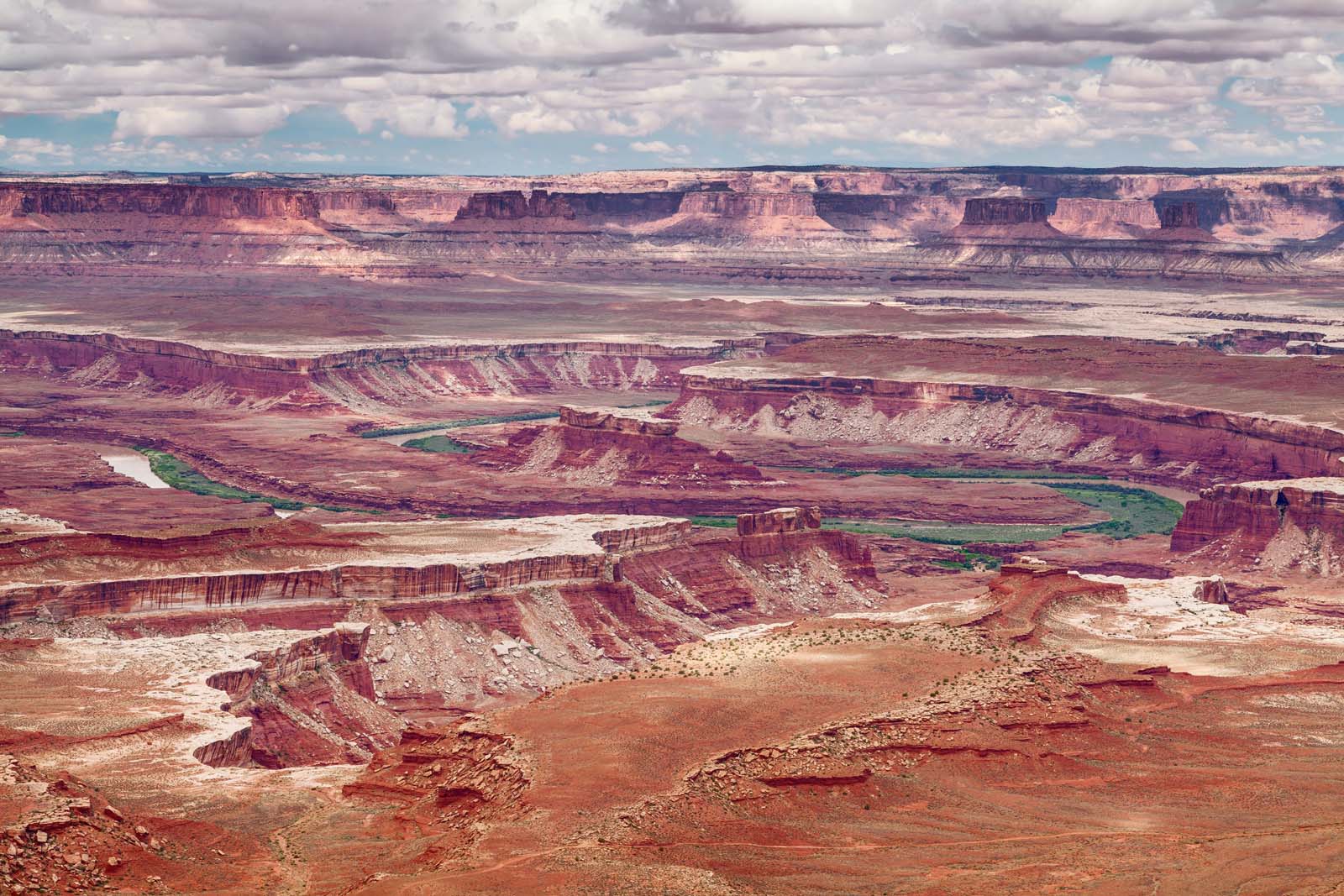
8. White Rim Trail, Island in the Sky
The White Rim Trail is another incredible trail within the Island in the Sky district of Canyonlands National Park. At just 2.9km out-and-back, the White Rim Trail is undemanding but offers extraordinary views.
Hiking the White Rim Overlook Trail, you’ll be rewarded with views of the Monument Basin, Colorado River, and the La Sal Mountains. Monument Basin is one of the most famous sights to spot from Island on the Sky, and it looks remarkably like the desert has a huge missing jigsaw piece.
Make sure to bring a camera, as White Rim is one of the most scenically rewarding hikes in Canyonlands National Park. Since it is a short and untechnical hike, you won’t find a camera a hindrance to carry either.
- Distance: 2.9km
- Difficulty: Easy
- Elevation gain: 49m
- Trailhead: White Rim Overlook Trailhead, Grand View Point Rd
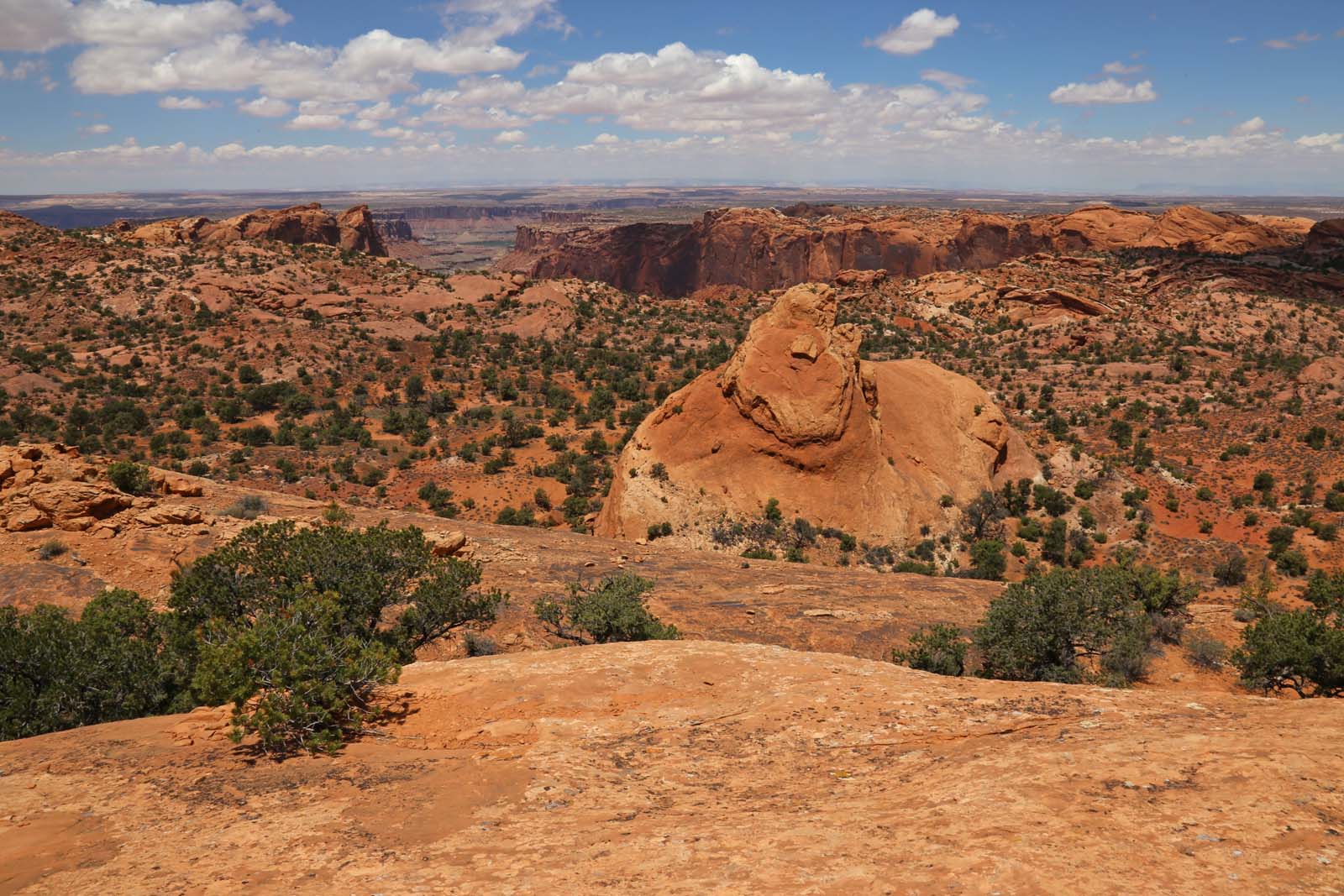
9. Aztec Butte Trail, Island in the Sky
The Aztec Butte Trail only takes an hour to complete. But don’t be fooled by its length. The route is mostly scrambling and involves a rapid elevation gain – making it physically and mentally challenging. Hiking boots are a must, and we’d suggest that you only tackle Aztec Butte if you are an experienced hiker.
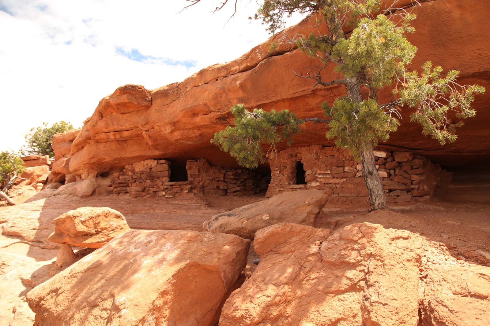
The Aztec Butte trailhead starts from Upheaval Dome Road. Spoiler alert: Butte means a steep-sided, isolated hill. You’ll be climbing lots of dome-shaped buttes, which have granaries and ancient cave-like structures that were used as storage.
These Puebloan archeological sites make exciting stop-offs en route. You’ll also have fantastic views of Taylor Canyon throughout to keep you motivated. Out of all the trails, the Aztec Butte Trail is the most historical of our hikes in Canyonlands National Park.
- Distance: 2.7km
- Difficulty: Moderately challenging
- Elevation gain: 79m
- Trailhead: Aztec Butte Trailhead, Upheaval Dome Rd
10. Whale Rock Trail, Island in the Sky
This short trail in Canyonlands National Park takes hikers to Whale Rock summit, an aptly named butte that is shaped like a whale.
The trail is family-friendly for those with older children and relatively straightforward. However, you should be prepared to scramble over a few rocks and complete an uphill section to reach the endpoint. There are well-maintained handrails to assist your ascent, and the Whale Rock distance to the summit is only ten to fifteen minutes.
The whole experience should take around half an hour – so it is well slotted into even the busiest itineraries. Whale Rock is located within the Island in the Sky district and is surrounded by other attractions. It is ideally combined with the nearby Green River Overlook, Mesa Arch, Aztec Butte, or Upheaval Dome.
- Distance: 1.3km
- Difficulty: Easy
- Elevation gain: 40m
- Trailhead: Whale Rock Trailhead, Upheaval Dome Rd
11. Gooseberry Trail, Island in the Sky
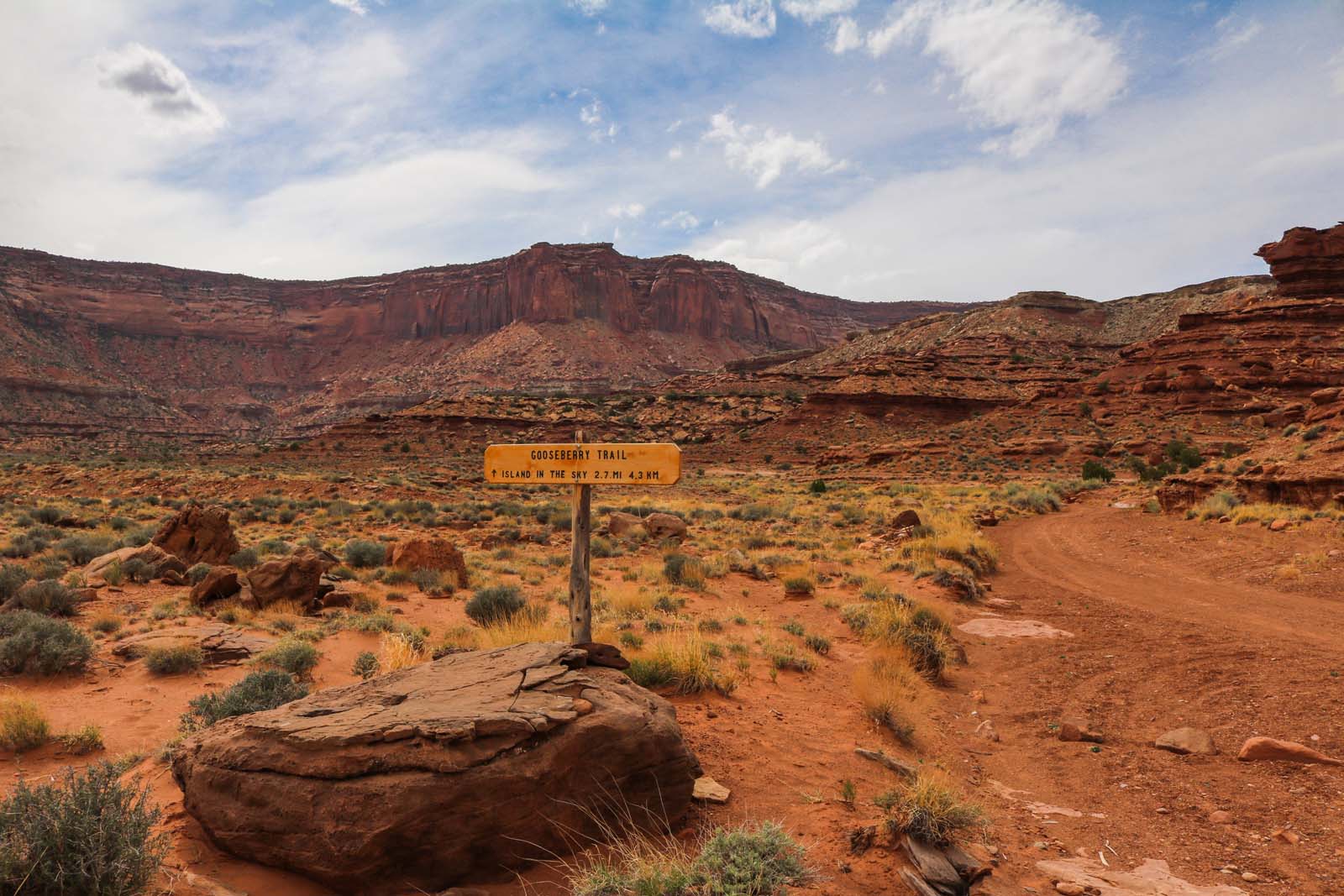
The Gooseberry hike distance might not be the longest of our Canyonlands hikes. Still, the trail is easily one of the most challenging. The Gooseberry Trail is the steepest on the Island in the Sky. You’ll gain over 470 meters of elevation during the hike.
In short, this trail is extremely steep and physically demanding. You’ll cross scree and loose terrain areas, so hiking boots are a must. You should bring food and water and research the route beforehand, as the trail is unmarked and poorly maintained in sections.
Of course, those who complete Gooseberry Trail are massively rewarded. The out-and-back route reaches a scenic viewpoint on the White Rim bench. You’ll have expansive views of the canyon and a huge adrenaline rush.
- Distance: 6.8km
- Difficulty: Difficult
- Elevation gain: 472m
- Trailhead: White Rim Overlook Trailhead, Grand View Point Rd
12. Shafer Canyon Overlook, Island in the Sky
The Shafer Canyon Overlook trail is one of the easiest in Canyonlands National Park. You can complete the 0.5km out-and-back trail in less than fifteen minutes.
Shafer Canyon is a dramatic natural attraction that features a winding dust road down to the Colorado River at its base. From the Overlook mesa, you can take in a sweeping view of the entire canyon – without even walking one kilometer.
The trailhead is next to Neck Spring Trailhead, just off Great View Point Rd. It is centrally located on the Island in the Sky and is minutes away from the visitor center, so it is a good place to start a day of exploring.
- Distance: 0.5km
- Difficulty: Easy
- Elevation gain: 14m
- Trailhead: Great View Point Rd
13. Druid Arch Trail, Needles
Druid Arch Trail cuts straight through the Needles district in Canyonlands National Park. The five-hour trail passes through narrow canyons, past Chesler Park, and includes a series of engaging trail features like a fixed ladder.
A taste of adventure is a definite requirement to complete this 16.7km route. However, Druid Arch will make it all worthwhile at the endpoint. The sandstone arch is over 150 feet tall and coins its name from its resemblance to Stonehenge – which is widely suspected of having been a Druid temple.
It is worth wearing a small backpack so that you can bring a camera and snap some shots of Druid Arch. You should also bring food and water to keep you refreshed on the hike. In terms of nearby accommodation, Squaw Flat Campground is a popular campsite. You may wish to consider camping in the Needles district so that you can maximize your hiking time in the local area.
- Distance: 16.7km
- Difficulty: Moderately challenging
- Elevation gain: 492m
- Trailhead: Squaw Flat Trailhead, Federal Rte 2444
14. Buck Canyon Trail, Island in the Sky
If you want a short but scenic walk on the Island in the Sky, the Buck Canyon Trail is one of the easiest in Canyonlands National Park. At just 0.2km, it is actually a stretch to call walking to Buck Canyon Overlook a hike. You can complete the walk in less than five minutes, so it is an incredible sunrise, sunset, or family spot.
The Trail has a cemented and completely flat surface. Wheelchair users and families with strollers can easily navigate the route and enjoy the overlook. Out of all the Island in the Sky trails in Canyonlands National Park, this is the most accessible.
Buck Canyon Overlook is also good near the Murphy and White Rim Overlook trails. You could easily add it on to either of these hikes, as it is so short and non-exerting.
- Distance: 0.2km
- Difficulty: Easy
- Elevation gain: 0m
- Trailhead: Buck Canyon Overlook, Grand View Point Rd
15. Horseshoe Canyon Trail, Horseshoe Canyon
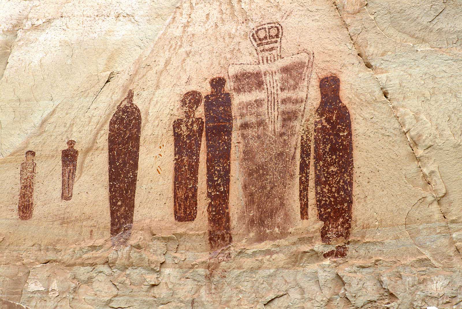
Horseshoe Canyon Trail is the most interesting hike in Canyonlands National Park. And, even better, the route is only moderately challenging. Even the most inexperienced hiker can complete this untechnical trail with a bit of mental grit. But why should you? What is so special about Horseshoe Canyon Trail?
The trail’s endpoint is the Great Gallery, where you can admire ancient Native American rock art. The art is known as petroglyphs or pictographs, and the most famous show is the ‘Holy Ghosts’. The ‘Holy Ghosts’ are reddish-painted figures that appear human-like but are depicted ominously hovering.
The rock art is so historical that we’d recommend the Horseshoe Canyon Trail as a bucket list hike for anyone visiting Canyonlands National Park. And, if you are an art or history enthusiast, it is worth visiting the National Park just for this hike – even if you have to detour from as far away as Salt Lake City.
You should allow four hours to complete the entire hike. Be mindful of preserving the art and trail, and pay attention to any signs from the US National Park Service.
- Distance: 11.3km
- Difficulty: Moderately challenging
- Elevation gain: 423m
- Trailhead: Horseshoe Canyon Trailhead, Mailbox Rd
How To Have The Best Hiking Experience
You should have some trail ideas now that we’ve covered the best hikes in and around Canyonlands National Park. However, there are still some crucial details that you should note.
Let’s dive straight into our top tips to have the best hiking experience.
Pack The Correct Supplies
If you set out on a five-hour hike in Canyonlands National Park with half a bottle of water, you will not have an enjoyable time.
The most important tip to having a fun hiking experience when visiting all national parks is to pack the correct supplies. When packing a hiking backpack, you need to consider the weather, trail conditions, and trail length. Will you need to bring food? Will you need to bring spare clothes? How much water will you drink?
On long day hikes, we’d recommend bringing food, a few bottles of water, sun cream, a portable charger, and a head torch (just in case). While, on short hikes, you might be fine to bring just a bottle of water.
Wear Suitable Clothing
It is surprising how many people embark on challenging hikes with unsuitable clothing – especially footwear. Accidents are inconvenient and dangerous in isolated areas, so arrive prepared with suitable clothing.
Like Utah’s other national parks, Canyonlands National Park can reach scorching temperatures yet also be slippery and frosty in winter. It is essential to dress for the season and pay close attention to the weather forecast before embarking on a hike.
A hat and hiking shorts may be best in summer, yet you might want to bring a thermal layer and gloves in winter. Remember that sunrise or sunset hikes will be cooler all year round.
In terms of footwear, even shorter hikes like Whale Rock Trail require sturdy hiking boots. Protecting your ankles from rolling on loose surfaces and grip is important on tricky terrain.
Hike Early In The Day
Hiking in the midday heat is not only uncomfortable and sweaty. In July and August, hiking at midday is also dangerous.
Trails in Canyonlands National Park have very little shelter from the sun, meaning hikers are at high risk of heatstroke and sunburn. Where possible, aim to hike early in the morning to avoid being on the trails in the midday heat.
You should always bring a hat, wear sunscreen, and bring plenty of water. Keeping hydrated and maximizing your protection from the sun is the bare minimum when hiking in Canyonlands. However, hiking early in the day is probably the best advice.
Final Thoughts
Hiking in Canyonlands National Park is an unforgettable experience. Whether you head to Needles, Canyonlands Rivers, Horseshoe Canyon, or Island in the Sky district, you’ll have a fantastic time.
When deciding where to stay, you may wish to choose accommodation in Zion National Park and travel into Canyonlands. Zion National Park has a great selection of accommodation, and we’ve already covered the best areas to stay in this article.
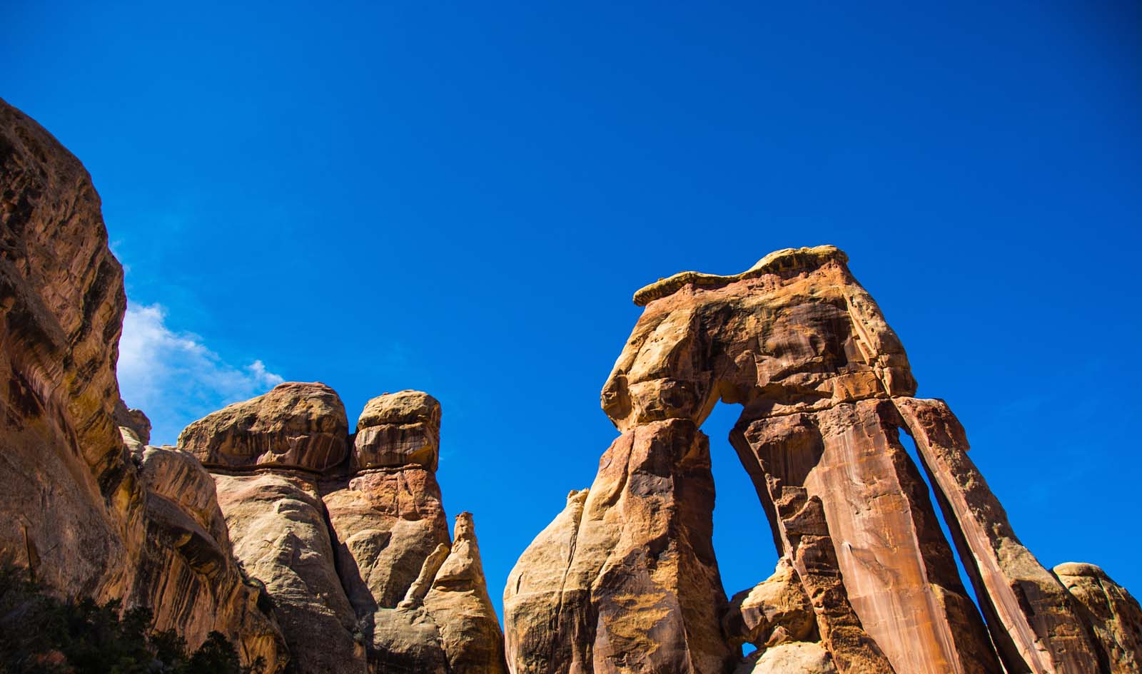
Don’t forget to visit Capitol Reef National Park, Bryce Canyon, and Arches National Park as well – all of these national parks are within driving distance of Canyonlands. We particularly recommend Arches National Park if you liked the Mesa Arch in Canyonlands. But once you experience one of Utah’s parks, you’ll want to see them all.

Muy buena informacion . Viajare en agosto 2022 y la informacion me servira muchisimo