Many travelers know about the world-renowned Golden Gate Bridge in San Francisco and flock there as soon as they get to the city and they should, it’s an icon of San Francisco. As someone who has lived in the city for almost two decades, tourist attractions in San Francisco are nice, but I want to share one way to spice up the experience of visiting the Golden Gate Bridge and the San Francisco Bay area by combining it with lesser known but still great hiking spots and vista points. These are the best hikes in San Francisco to get you outdoors and offer amazing views.
Table of Contents
Best Hikes in San Francisco, California
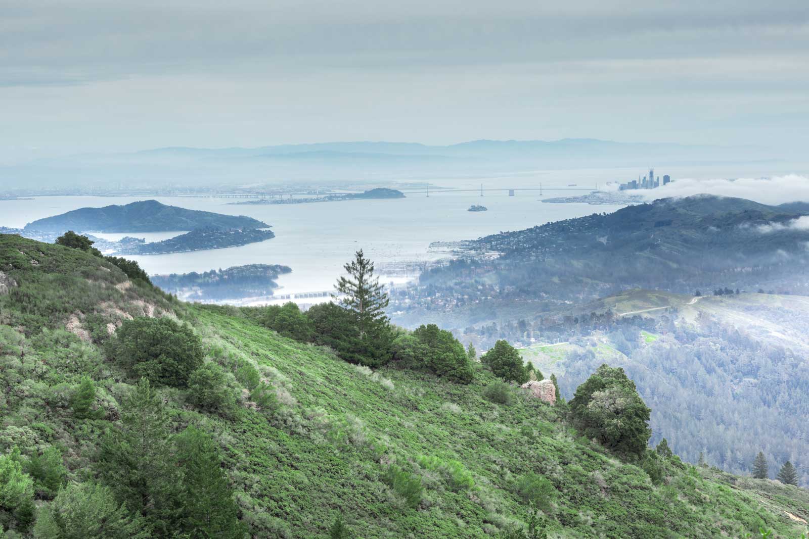
1. Golden Gate National Recreation Area

Most travelers tend to start their Golden Gate Bridge walk at the base of the bridge, turn around and walk back. They take some pictures along the way and go home. That isn’t bad, but to get more exercise, take in better views, and end up feeling more satisfied by having a day full of more varied experiences let’s take things a bit further.
The Golden Gate National Recreation Area boasts miles of hiking trails, and unobstructed views and is the perfect way to see a different side of San Francisco. It spans both the Marin and San Francisco sides of the Golden Gate Bridge and has hiking trails for every fitness level. For more information on hiking and parking visit the Golden Gate Bridge Website.
Visiting San Francisco?
- Check out our post Where to Stay in San Francisco – A Guide To The Best Neighborhoods
- Or you can browse these San Francisco Hotels at a Glance
- Fairmont Heritage Place – Best Luxury 5-Star Hotel in Fisherman’s Wharf
- The St. Regis – Best Luxury SoMa Hotel
- JW Marriott Union Square – Best Union Square Luxury Hotel
- Four Seasons – Best Luxury Hotel in San Francisco at Embarcadero
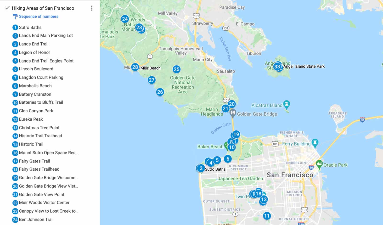
2. Lands End
The trail along Lands End Hike isn’t too long, but it is quite magical. The walk offers tremendous vistas unique to San Francisco. On a clear day, the hikers can see far into the depths of the Pacific Ocean to the west, the Marin Headlands to the north, and the Golden Gate Bridge to the east.
Start off in the Outer Richmond area at the edge of Lands End Golden Gate Area near the Cliff House and the historic Sutro Baths and Park at the Lands End Main Parking Lot. From there, a trail leads into Lands End within the Golden Gate National Recreation Area, and your adventure starts.
The area is called Lands End because it is located literally at the end of all land to the west as its cliffs end at the base of the Pacific Ocean. The narrow trail that parallels the cliffs doesn’t disappoint. It quickly leads the travelers right along the edge of the cliffs, below which the Pacific Ocean waves crash into the rocks.
Surprisingly, the park also has one of the best art museums in San Francisco. The Palace of the Legion of Honor is a great place to take a break for an hour or two and take in some Picasso and Rembrandt before finally heading off to Golden Gate Bridge. The Lands End Trail ends (no pun intended) on a street called El Camino Del Mar, which has some of the best views of the ocean in the entire city and is in a prestigious neighborhood.
Viewpoints include the Sutro Baths, Eastern Coastal Trail Lookout, Lands End Labyrinth, Dead Man’s Point and the Golden Gate Bridge.
- Trail Length: 5.5 KM
- Estimated Time: 1.5 hrs
- Difficulty Level: Moderate
- Website: Golden Gate Recreational Area
- Parking Lot Directions Google Maps
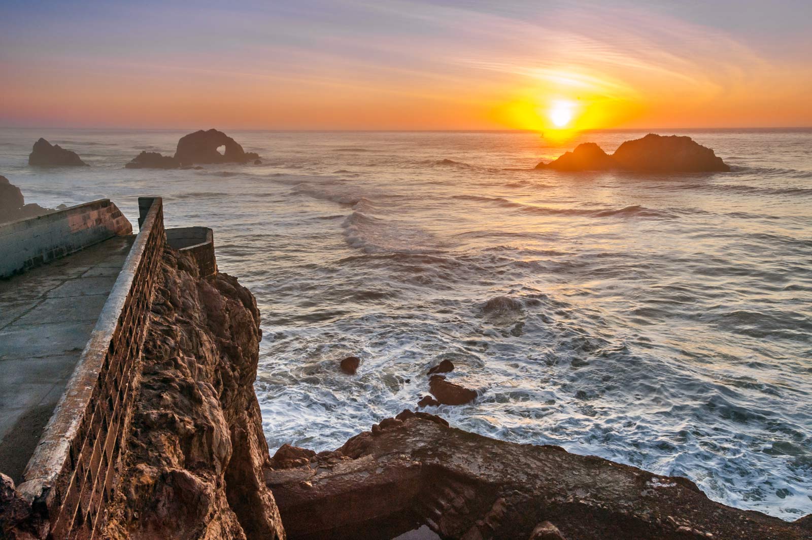
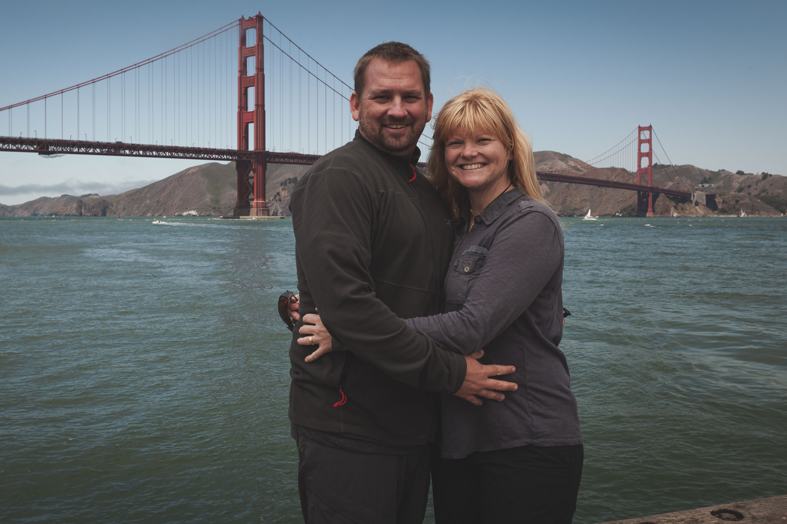
3. Golden Gate Bridge
Walking back from Lands End Trail, you can walk all the way to the Golden Gate Bridge. The street El Camino Del Mar passes China Beach and then turns into Lincoln Boulevard, which leads toward the Golden Gate Bridge. It is a highway-like street, but pretty soon, smaller walking trails become available as detours and lead towards the bridge via a quieter and more scenic walking route unhindered by cars.
Once on the bridge, the traditional and classic experience of walking the bridge offers some of the same views of San Francisco Bay from a much different angle. In addition, as you get closer to the other side of the bridge, views of San Francisco downtown open up, with the iconic Transamerica building standing tall above the rest.
On warm and clear days, many little sailboats are right below the bridge, all around the bay, and near Alcatraz Island. In addition, many gigantic freighter ships are coming into the San Francisco and Oakland ports from everywhere in the world. All the ships to these ports come through the bay and they are quite a treat to see. On lucky days, there are even military vehicles that come into the port and I have personally ever seen a submarine cruising above the water about ten years ago.
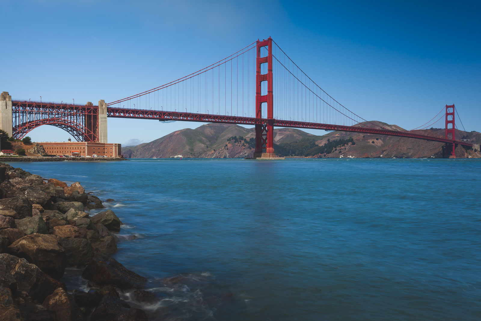
4. Batteries to Bluffs
Sticking around the same area as the Lands End hike is the Batteries to Bluffs trail hike in San Francisco. Located in San Francisco’s Presidio, a 1,500-acre park on a former military post, the Batteries to Bluffs trail hike offers views of the Golden Gate Bridge, the San Francisco Bay area, and the rugged coastline. This is just a 2-mile (3.2 km) hike round trip, so it can easily be added to your San Francisco Itinerary.
The trail starts at Lincoln blvd where you can park at the Langdon Court Parking lot. This parking lot connects to the trails leading to the Golden Gate Welcome Center which features the Golden Gate Overlook and the batteries used to protect the Golden Gate Bridge and San Francisco from 1891 to 1946. You can walk through these historic sites with views of the Golden Gate Bridge from Presidio, Battery Boutelle, Battery Marcus and Battery Cranston.
The Golden Gate Overlook is one of the premier spots to photograph the Golden Gate Bridge so the trail is busy, but for good reason. It offers the best views of the Golden Gate Bridge in the city. There are a lot of wooden steps along this hike and one of the best places to for sunset is to take the steps down to Marshall’s Beach.
- Trail Length: 3.5 KM
- Estimated Time: 1 hr
- Difficulty Level: Easy
- Website Information: Presidio Government Website
- Parking Lot Directions Google Maps
5. Twin Peaks
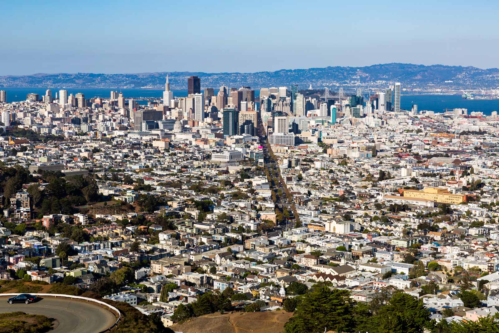
Twin Peaks is one of the best San Francisco hiking trails for spectacular city views. It is a heavily trafficked trail 3.4 mile loop trail, and you can drive or cycle up to the lookout. Twin Peaks is an urban hiking trail located within the city limits it is the second tallest peak in San Francisco (922-foot tall ) that overlooks the entire San Francisco Bay area, and the city’s landmarks. The hike feels far away from the city with forest trails, eucalyptus trees, rocky outcrops, wooden walkways and dirt paths taking you up to Eureka Peak and Noe Peak.
Starting in Glen Canyon Park, the Twin Peaks trail climbs 1.7 miles to Eureka Peak and Noe Peak and then descend on the North Side to Christmas Tree Point for the best views of the Pacific and the city of San Francisco. Christmas Tree Point got its name from the giant Christmas tree that is erected each year by the city. On the way back, hop on to the Gum Tree Girls Trail for a different perspective.
- Trail Length: 3.4 KM
- Estimated Time: Less than 1 hr
- Difficulty Level: Easy
- Website: SF Parks and Recreation
- Christmas Tree Point Co-ordinates
6. Mount Sutro Loop

If you want to continue walking, it’s another 1.1 miles from Twin Peaks along the road to the Mount Sutro Open Space Reserve with hiking trails and greenspace overlooking the city. Or you can walk this 1.9 mile loop trail (3.2 kilometer) along The Historic Trail from 17th and Stanyan. It takes you up to the Mount Sutro Open Space Reserve which is a 61 acre open space reserve owned by the UCSF. It is a popular spot for locals with 5 miles of public, multi-use trails, and a 900-foot elevation gain.
On the way down you can join the Fairy Gates trail to the Fairy Gates Trailhead at Stanyan Street to walk back along the street to where you started.
- Trail Length: 3.2 KM
- Estimated Time: Less than 1 hr
- Difficulty Level: Moderate
- Google Maps to Historic Trail Trailhead
7. Golden Gate Bridge to Marin Headlands
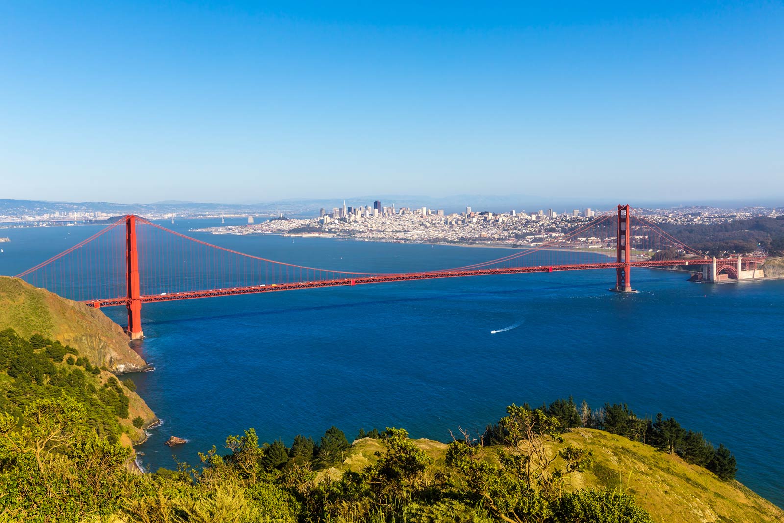
One of the most iconic things to do in San Francisco is to walk across the Golden Gate Bridge. Leaving from the Golden Gate Welcome Center a walk across the bridge to the Golden Gate National Recreation Area to the Marin Headlands. Most people find this enough of a walk, but if you want to explore more, There are plenty of hiking trails in the Muir Woods.
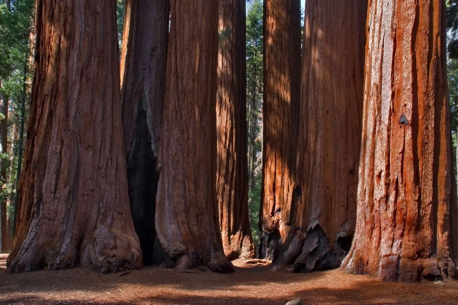
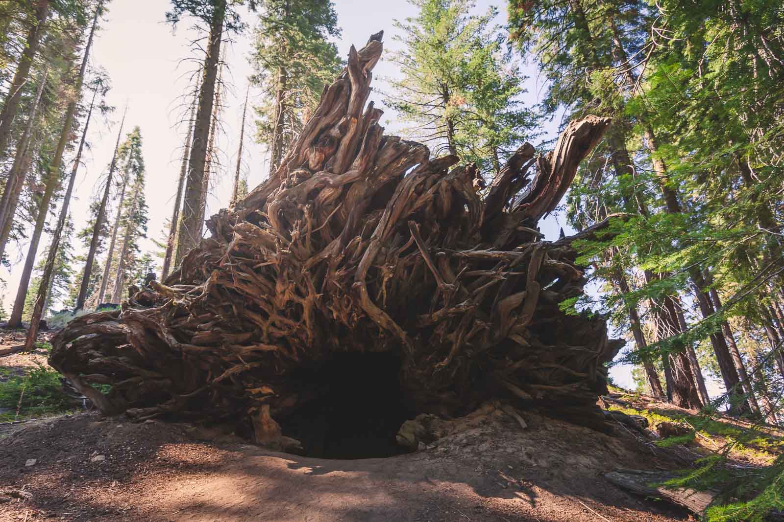
8. Muir Woods
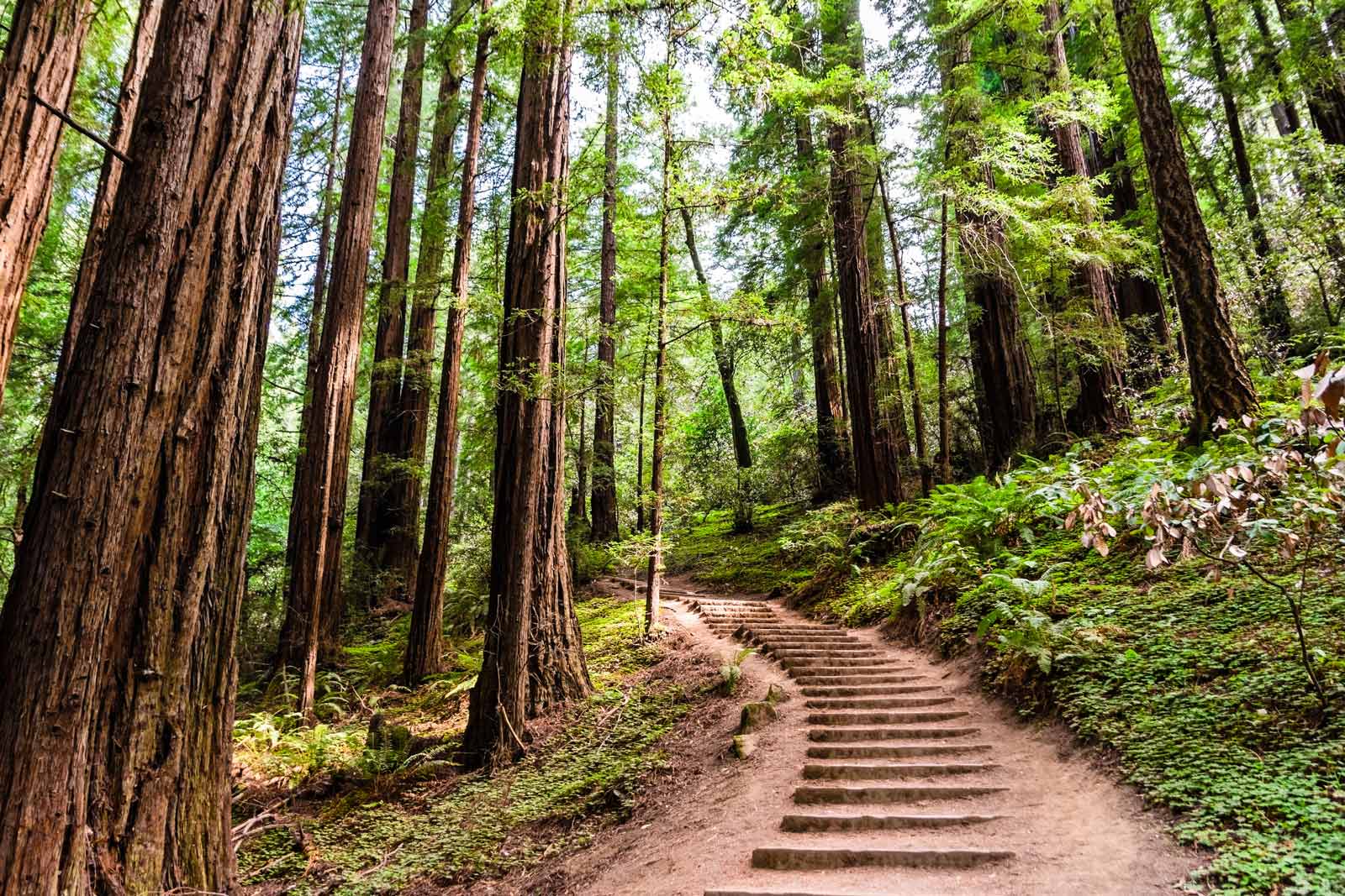
Located just outside of San Francisco, Muir Woods National Monument offers some of the most stunning hiking trails near San Francisco. There are plenty of different trails spanning across the 554 acres of Muir Woods. There are several trails in Muir Woods to choose from.
Note that Parking reservations are required in advance. Parking fills up quickly and if you don’t book in advance you won’t get in. Check with the National Parks Service for more information.
This beautiful area offers spectacular bay area hiking among the old-growth coastal redwoods. Muir Woods has various trails, with The Muir Woods Main Trail being a popular starting place that hooks up with other trails in the area.
Leaving from the Muir Woods Visitor’s Center and following Redwood Creek, this easy hike is done on a boardwalk and is suitable for all ages. It is a 2.0 mile loop trail (3.2 km) with only a 30-foot elevation gain.
If you are looking for a longer hike join The Ben Johnson Trail for a 6.3km loop that will take you through some of the most gorgeous landscapes in the Muir Woods National Monument.
Distance: 2.0 mi (3.2 km)
Elevation Gain: 30 ft
Time: 2 hours
Trailhead: Muir Woods Visitor Center
Google Maps Directions
9. Mount Diablo State Park
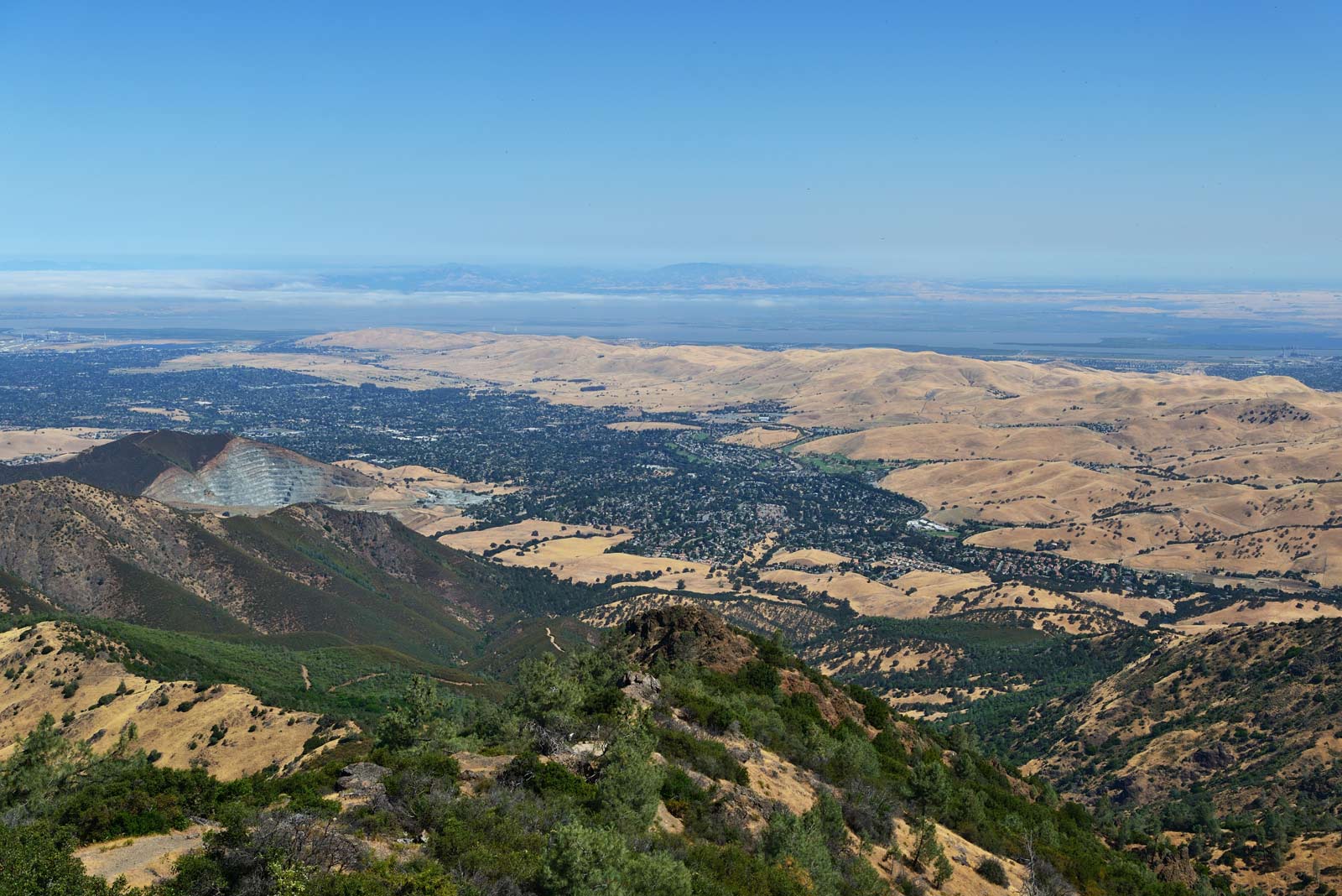
If you are up for a bit of a drive outside of San Francisco, you can head out to Mount Diablo State Park, which is about a 40 minute drive east of the city. This is a perfect day trip and the views over East Bay hills are spectacular. The summit trail here ranges in length and difficulty and is best suited for seasoned hikers.
For the best views we recommend the Donner Creek Loop trail. This out-and-back trail has some of the most spectacular views and is more of a moderate trail.
Start in the parking lot at the north entrance at Regency Drive and hike along the Donner Creek Fire Road and then take the Back Creek Trail Back.
One of the reasons you’ll love this trail is that you actually pass a few waterfalls and weave through the plains during the second half of the trail. If you are looking for a day of hiking, near the San Francisco bay area make sure to check out this State Park.
10. Tennessee Valley Trail, Marin Headlands
Located just north of the Golden Gate Bridge, the Tennessee Valley trail is a hike that leads to a sandy beach a beautiful lookout. You can choose from two different beaches. From the Tennessee Valley trailhead, you can either hike straight to Tennessee Beach for an out-and-back hike or do the more challenging loop to Muir Beach via the Pirate’s Cove Trail. This hike starts from the Tennessee Valley Trailhead and is about a 9-mile loop.
If you choose the Tennessee Valley trail it winds its way through beautiful coastal hills and ends at the beach at Tennessee Cove. Here you can have a picnic and take in the views of the Pacific Ocean. See more: 24 Of The Best Beaches in California
Distance: 7.0 mi (14.6 km) via Muir Beach Loop
Elevation Gain: 900 ft
Time: 4 hours
Trailhead: Tennessee Valley Trailhead
11. Angel Island State Park
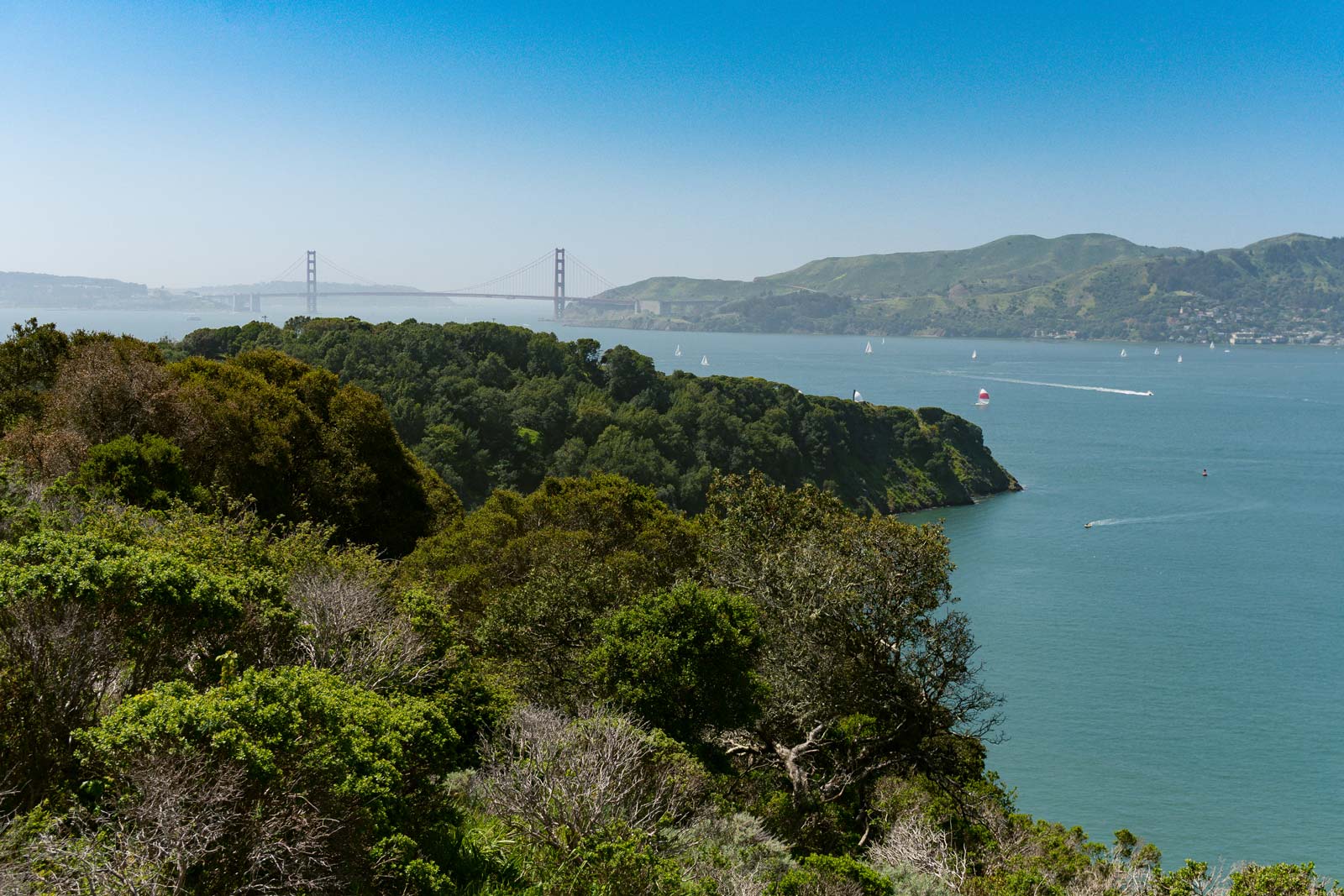
Surprisingly, Angel Island State Park is an often overlooked place to hike in the Bay Area, even though it is only a 40min ferry ride from Pier 41 in downtown San Francisco. There are 2 main hiking trails in the state park. The Sunset Trail goes to the summit of Mount Livermore and is a little more challenging than the other one. The payoff is the 360 degree views of the skyline, the Golden Gate Bridge, and East Bay.
The other trail in Angel Island State Park is the Perimeter Trail. This is an easy hike and gives you many different viewpoints as well as places to learn about the history of the island itself. If you are visiting the bay area for a few days then Angel Island is definitely worth a visit even if hiking is not at the top of your list. You can also camp on the island.
- How to Get to Angel Island:
- You can take the public ferry from San Francisco Blue & Gold Ferry Service through Blue and Gold Fleet Ferry
- For more information check out the: Angel Island Website
12. Reinhardt Redwood Regional Park
Located in the East Bay Regional Park District, just a 20-minute drive from downtown San Francisco, Redwood Regional Park is best is known for the old growth redwood forest that makes for the perfect backdrop to any hike. It is actually the largest remaining natural stand of coast redwood in East Bay.
Our recommendation is to hop on the Stream Trail, Mill Trail, and French Trail Loop. This is a trail with a lot of ups and downs but the smell of the redwoods combined with the beautiful forest landscape make this a perfect hike especially when it gets really hot.
Start at the Skyline Gate Parking Lot and follow the Stream Trail until you come to where it meets the Mill Trail. Follow this for a bit until it hooks up with the French Trail and take this back to the parking lot.
Distance: 7.0 mi (11 km)
Elevation Gain: 1200 ft
Time: 3 hours
Trailhead: Skyline Blvd
Google Maps Trail Entrance Directions
Website Information
13. Mori Point, Pacifica
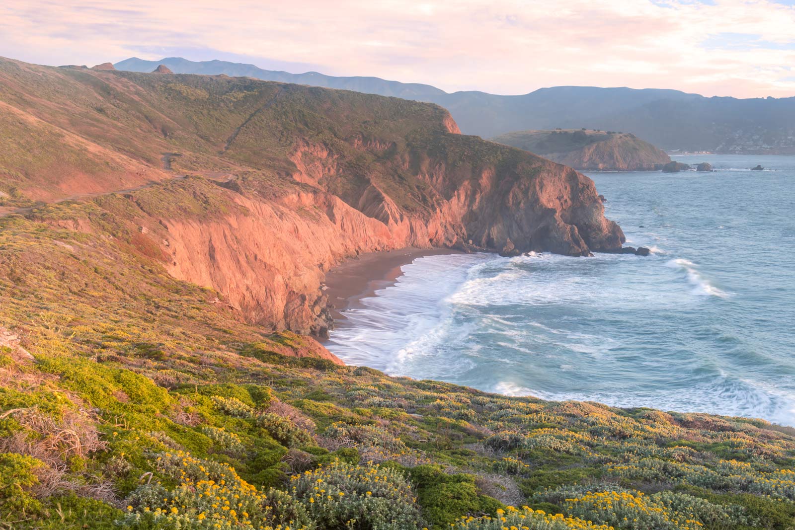
Mori Point is a spectacular lookout that is just south of San Francisco. Situated in San Mateo County, Mori Point offers a few different hiking trails that are along the coast. It also hooks up with the longer Coastal Trail. This 32 acre wetland park has some of the best views of the ocean in the Golden Gate National National Recreation area.
The 2 trails we recommend are the Old Mori Trail, which is more of a stroll as it is flat as a pancake. It does however bring you out to some incredible views. And you can head down the stairs to get to the beach if you like. Just remember, you have to come back up the 185 steps.
The other recommendation is the Mori Point Loop Trail. This 1.5-mile (2.4km) loop trail offers some great coastal views as well as wildflowers and wildlife. It can get windy along the coast and there are some steep sections, but it is worth it in our opinion. This is a perfect place to enjoy the sunset and spot whales.
Distance: 1.5 mi (2.4 km)
Elevation Gain: 1200 ft
Time: 30 minutes
Trailhead: Mori Point Parking Lot (Directions Here)
14. Tomales Point Trail at Point Reyes National Seashore
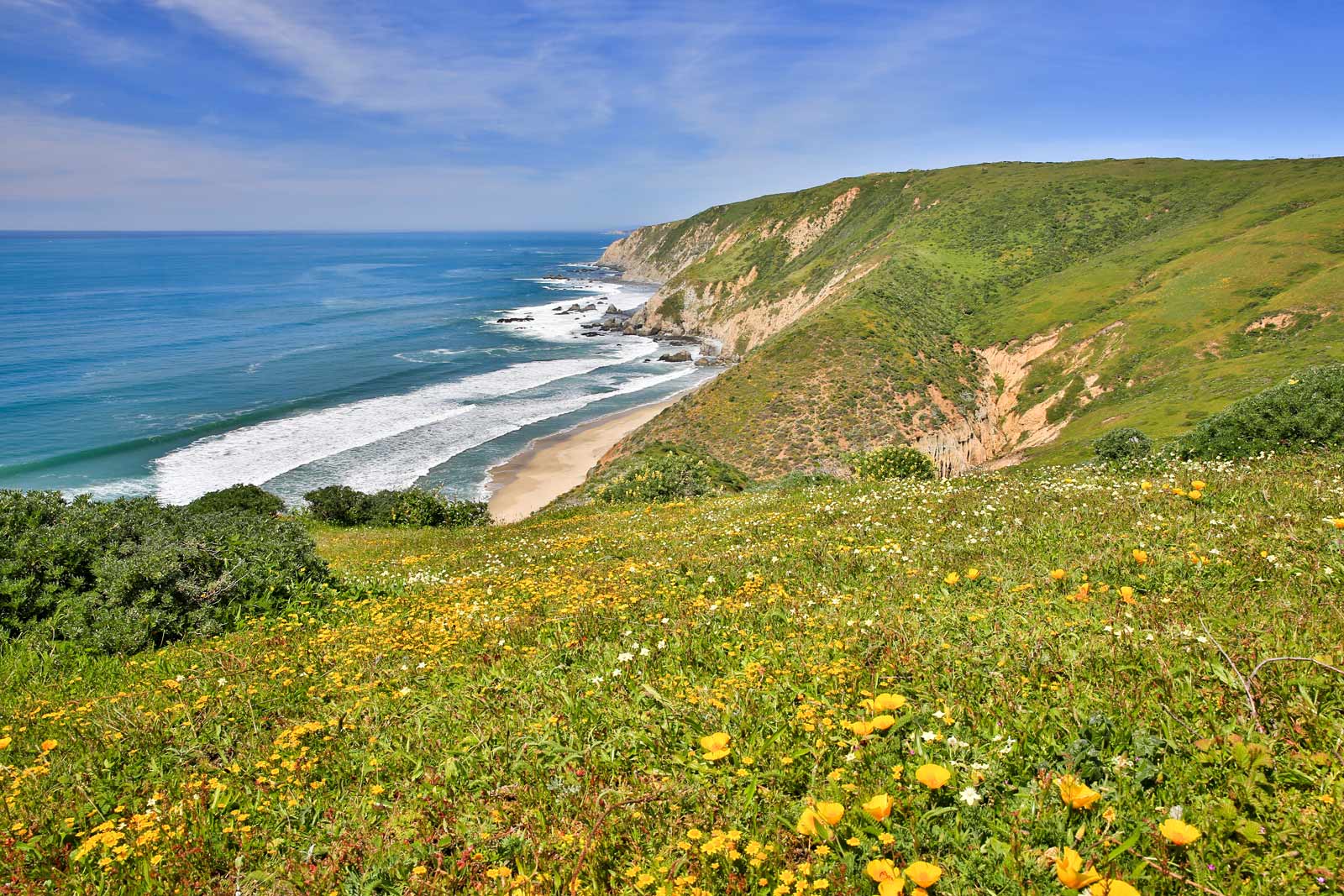
This hike is one of the classics. Not only because of the stunning views, but because it is one of the quieter hikes near San Francisco. The Tomales Point Trail is located in Point Reyes National Seashore between Tomales Bay and the Pacific Ocean.
There is a lot to see during this hike. Duck Beach, Sand Point, Tom’s Point and views of Bird Rock just to name a few. What is also cool is that it is entirely in the Tule Elk Preserve, so your chances of seeing some elk are pretty good.
This is an out-and-back trail so make sure to give yourself time to get back. One note, this trail is often covered in fog. This doesn’t take away from the hike itself, but if you put in the time to get to the lookout and it is fogged in you might be disappointed. That being said, the hike is worth it fog or no fog.
Distance: 9.4 mi (15 km) out and back
Time: 30 minutes
Trailhead: Tomales Point at Pierce Point Road
Directions to Trailhead via Google Maps
15. Mount Tamalpais state park
At Mount Tamalpais state park, there is a little bit of everything for everyone. Different trails with differing levels of difficulty and length. Beginners, seasoned hikers, walkers, joggers, and bikers all have a place at Mount Tam.
Its diverse landscape makes making it one of the most popular trails in the area. Enjoy stunning views of the rolling hills, oak forest, redwood, and scenic ocean on the trails.
The ultimate challenge is to hike all the way up to the mountain peak for a breathtaking view of the sea. Most visitors opt for a leisurely walk along the Dipsea Trail, steep ravine trail loop, and Matt Davis loop.
Distance: 60 mi (96 km) out and back
Time: Varies
Trailhead: Pantoll Ranger Station or the East Peak Center
16. Half Moon Bay Coastal Trail
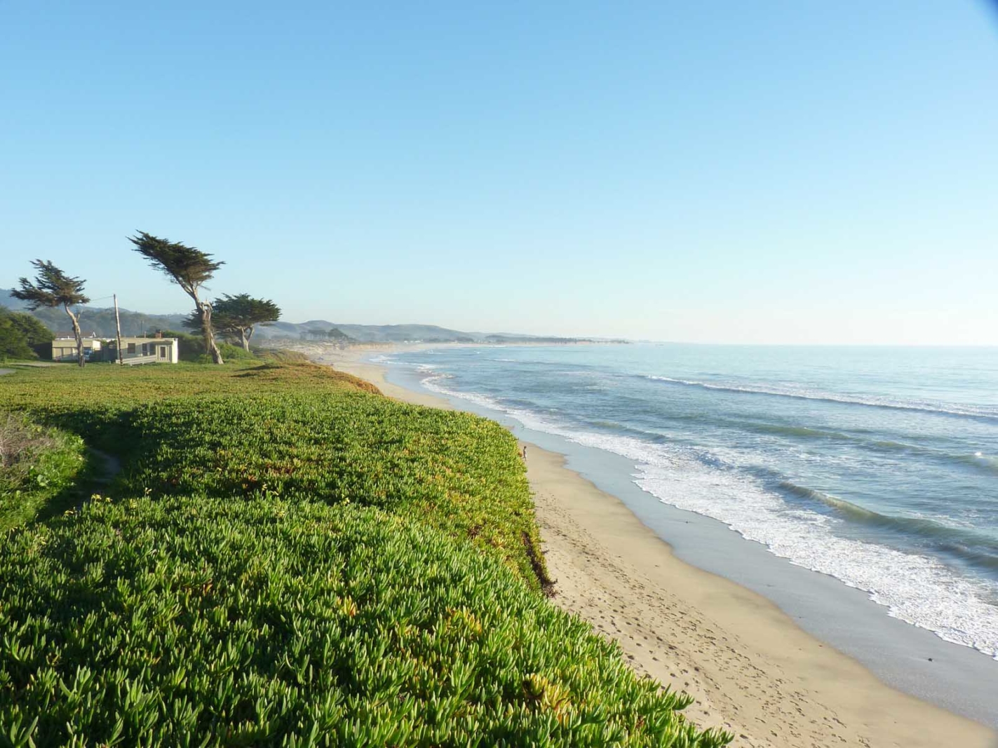
Also known as the coast side trail, enjoy scenic trails with breathtaking views of the pacific ocean. Even though this trail is on a cliff it’s probably one of the easiest on this list as the entire terrain is mostly flat. The hiking trail is about 6-mile roundtrip and is perfect for bikers, walkers, or hikers.
The entire path is well-maintained and very easy to walk, consider it more of a scenic walking route. Enjoy gorgeous views of real swimming in the ocean and birds floating about. The best part is the cooling breeze from the ocean that makes the hike well worth it.
Distance: 7.5 mi (12 km) out and back
Elevation Gain: 213 ft
Time: 1hr 15 minutes
Trailhead: Miramontes Point Road
What to Pack for your San Francisco Hikes
When it comes to hiking around the San Francisco area you want to make sure you pack a few necessities as the weather can change quickly and you want to be prepared for any situation, even on the shorter hikes. Here is what we suggest you pack in a day pack before hitting the trails.
- Water
- Camera or Smartphone
- Day Pack
- Hiking Jacket (Waterproof and windproof)
- Hiking Shoes or Running Shoes
- Snacks
- Beanie or warm hat
- Sunscreen
- Sunglasses
Regardless of which hike you choose, getting out onto the trails is a great activity to add to your San Francisco Itinerary. To say that we were impressed with the sheer amount of trails would be an understatement. Pair that with the coastal views and how well-maintained the trails are and it is easy to see why San Francisco is a great place to hike.
Author Bio
Alex Genadinik has lived in San Francisco for over 15 years and enjoys the Northern California outdoors. He is currently working on uniting the many different small hiking groups dispersed throughout the Bay Area into a more united outdoor community. You can find out more about great San Francisco hikes at Hiking San Francisco. This post has been updated by ThePlanetD Team.
More San Francisco Planning Resources
- Accommodation: Where To Stay In San Francisco – A Guide To The Best Neighborhoods
- Itinerary Suggestions: 72 Hours In San Francisco – A Local’s Guide To The City
- Photography Suggestions: The Ultimate San Francisco Photography Guide
- Northern California: 7 Epic Places To Visit In Northern California
- Monterey: 20 Great Things to do in Monterey, California
- Carmel By the Sea: Things to do in Carmel by the Sea, California
- San Mateo: Things to do in San Mateo, California

travelling is love, thank you
Regards,
Advane Joseph
My uncle lived in San Francisco f9r about 4 to 5 years, I sent him this list and he was like what!!! These places were in San Francisco?
Amazing read! Under the current circumstances, traveling isn’t possible but The Planet D has become my happy place now and hive me hope that things will be better soon and tyen we can visit all these amazing places.